Architecture, Engineering & Construction
Scan to BIM support, site documentation, progress capture, design communication, and revision ready deliverables for architects, engineers, owners, and contractors.
Integrating Ai, architecture, civil engineering, surveying, and technical media into turnkey deliverables for global infrastructure and development.
Technical media, geospatial capture, digital twins, and visualization workflows for teams that need measurable outputs, stakeholder clarity, and fast deployment.
Scan to BIM support, site documentation, progress capture, design communication, and revision ready deliverables for architects, engineers, owners, and contractors.
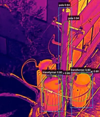
Corridor mapping, utility asset documentation, Ai assisted inspection workflows, and geospatial reporting support for distributed field conditions.
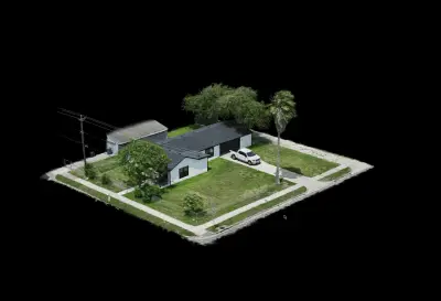
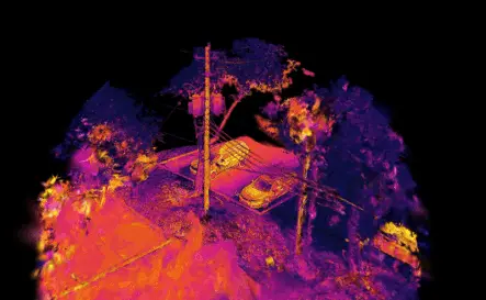
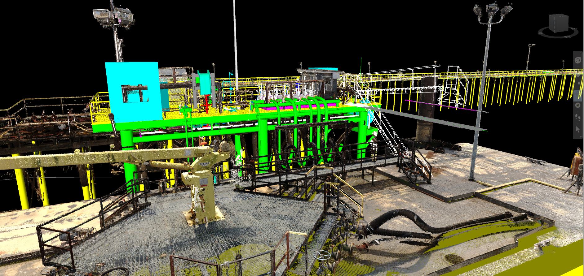
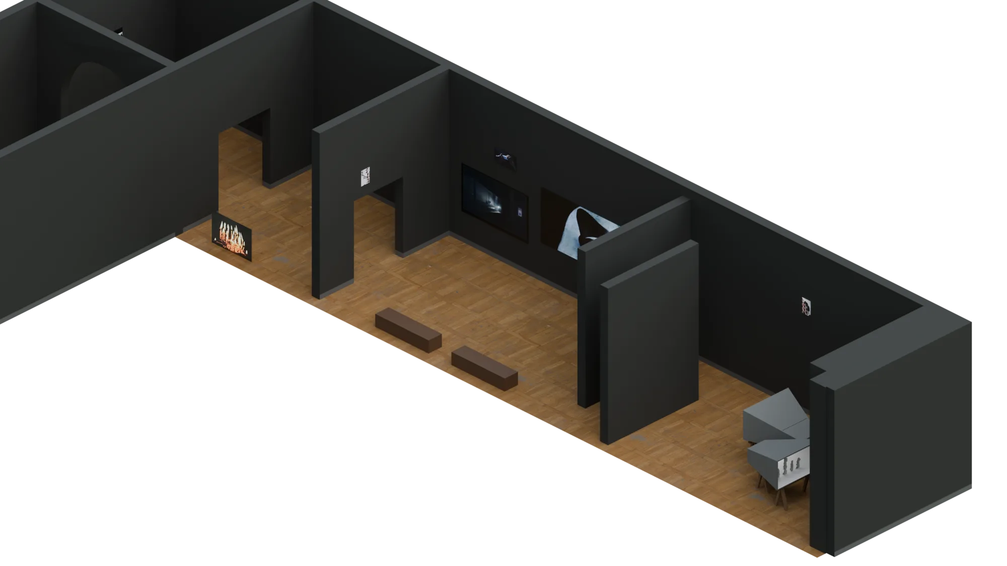
Large site digital twins, thermal 3D Gaussian Splatting, facility capture, remote visual review, and technical media for operations, maintenance, and planning teams.
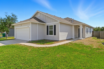
Listing media, Ai HDR photo delivery, Street View visibility, 3D tours, and polished marketing visuals for broker, developer, and portfolio use.
Documentation support, deliverable standardization, partner deployment models, and scalable visual workflows for statewide and regional scopes.
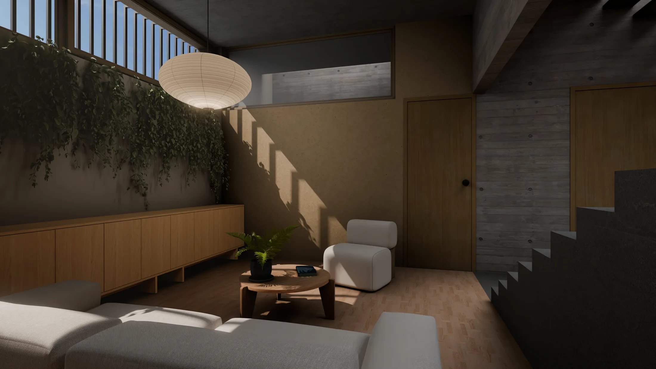
Photoreal rendering, previsualization, digital twin previews, and presentation ready imagery for proposals, investor materials, and stakeholder review.
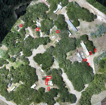
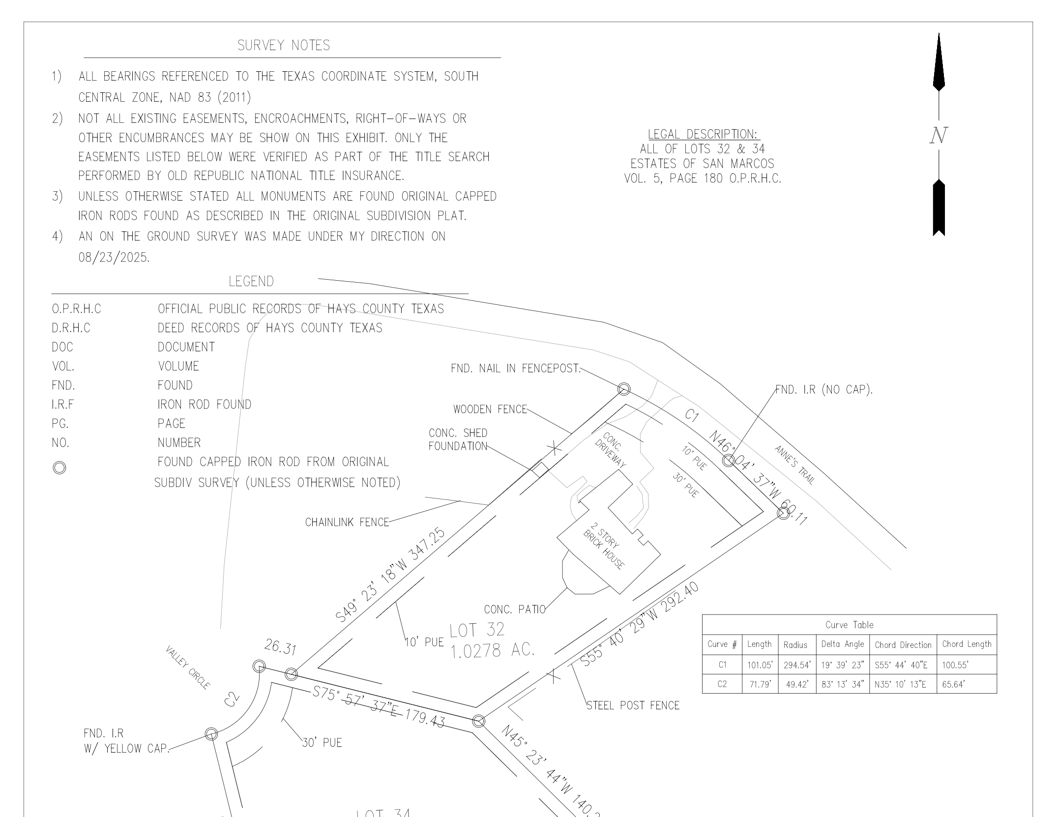
Orthomosaics, DSM/DTM surfaces, contour outputs, volumetrics, georeferenced imagery, and GIS/CAD ready exports for planning, documentation, and change tracking.
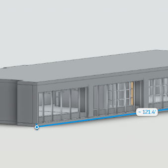
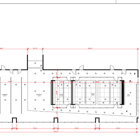
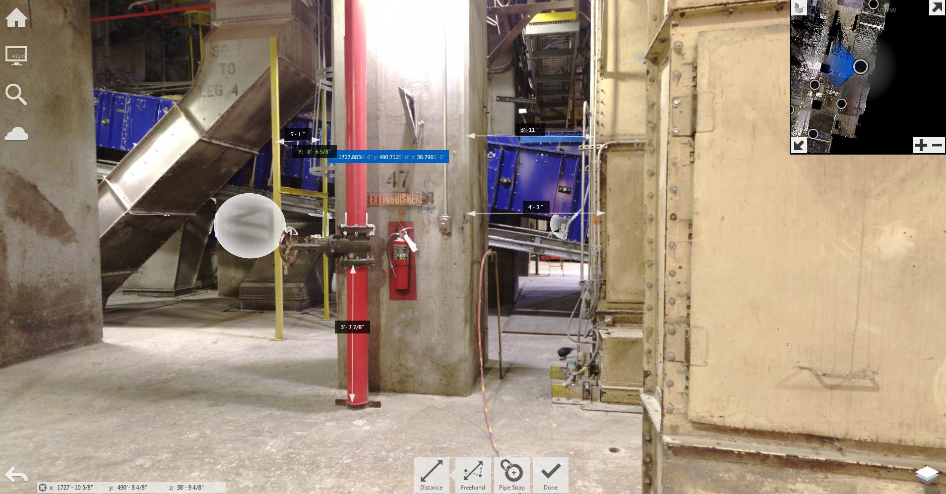
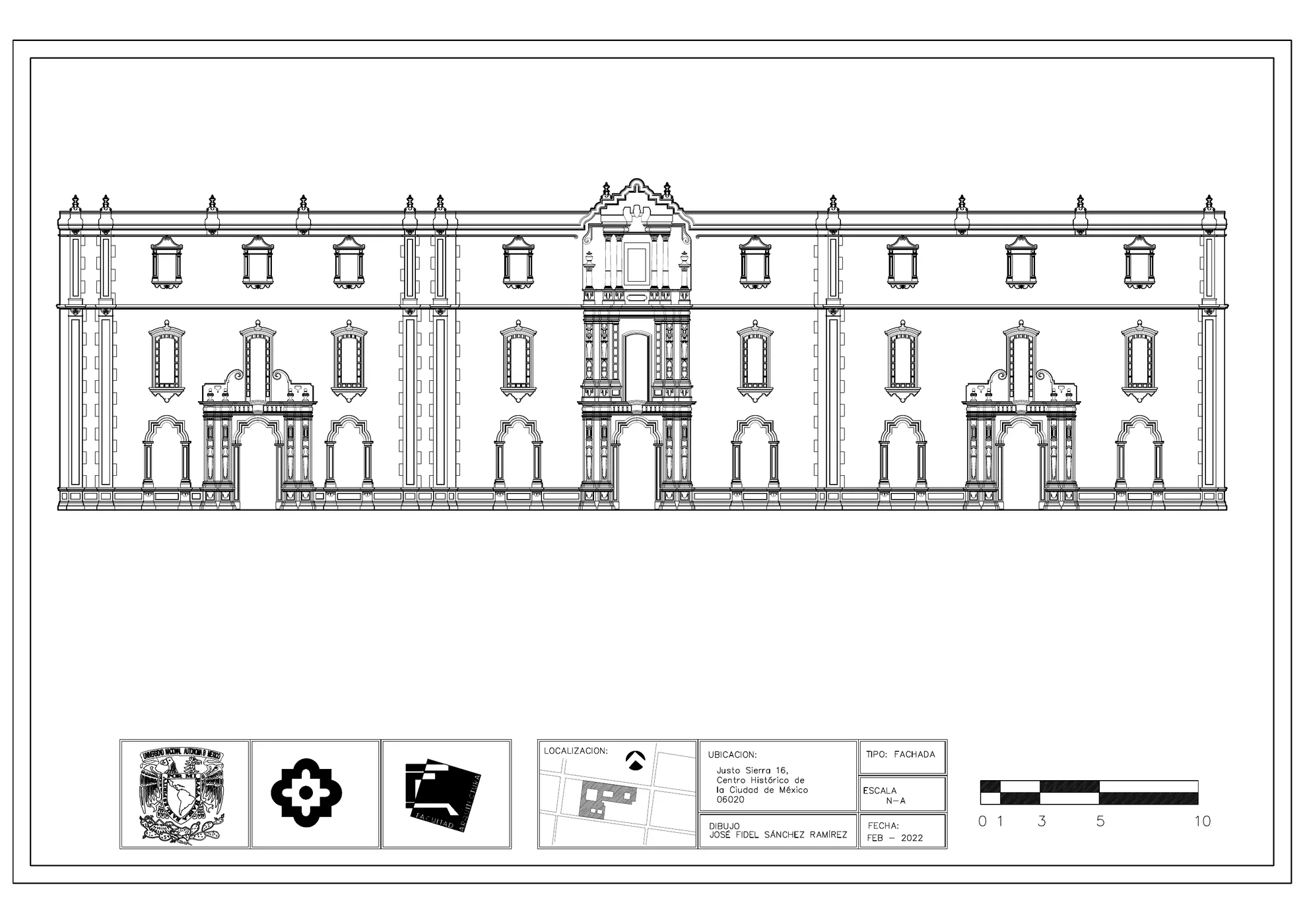
Registered point clouds, scan to CAD support, scan to BIM support, floor plan references, elevation references, Revit/CAD source data, and structured documentation packages.
Photorealistic renders, CGI stills, listing photography, Ai enhanced media sets, Zillow ready and MLS ready assets, and presentation visuals for stakeholders and proposals.
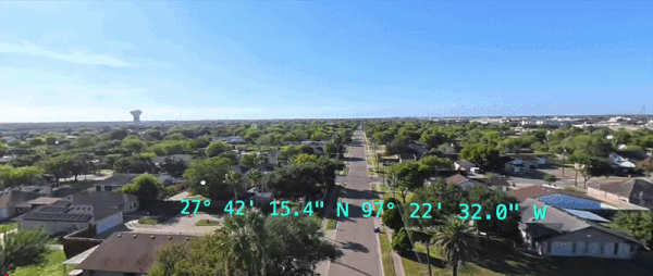
3D Gaussian Splats, Matterport tours, Street View publishing, Google Maps integration workflows, drone 360° video, and scene based web deliverables for remote review.
Send the address, plans, KML, priorities, deliverable types, schedule, and access constraints so the workflow can be matched to project intent.
AeroFrohne deploys drone, LiDAR scanning, 360° visuals, 3D rendering, or Ai assisted workflows based on accuracy needs, end use, site conditions, and stakeholder requirements.
Deliverables are reviewed, organized, and packaged for CAD, BIM, GIS, web, inspection support, marketing, or executive stakeholder use.
Drone mapping, 3D LiDAR, Street View, Ai inspection, real estate media, rendering, and immersive 3D deliverables under one visual and technical workflow umbrella.
AeroFrohne is structured around usable deliverables that help teams measure, coordinate, market, inspect, or defend decisions rather than just gather imagery.
Projects can be supported through direct deployment or through teams across the world
Clients can combine documentation field capture with polished stakeholder facing visuals instead of splitting work across multiple vendors.
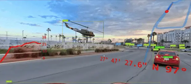
Using RTK and PPK workflows with GNSS base stations and ground control points, AeroFrohne can achieve approximately 1–8 cm RMSE absolute accuracy for mapping depending on scope of work, control strategy, terrain, vegetation, and field conditions. Ground LiDAR accuracy varies by equipment, environment, and workflow.
Yes. AeroFrohne can support projects across Texas and nationwide either through direct deployment or through subcontractor deployment models depending on scope, timeline, and location.
Typical deliverables include point clouds such as LAS, LAZ, E57, and RCP; meshes such as OBJ, PLY, and FBX; CAD and BIM support formats such as DWG, DXF, and RVT; orthomosaics and raster products such as GeoTIFF; plus PDF, JPG, WebP, and SPLAT depending on project requirements.
The best starting package is the site address, scope summary, plan set or marked PDF, KML/KMZ if available, deliverable expectations, target schedule, and any safety or access requirements.
Yes. AeroFrohne can combine aerial capture, LiDAR, immersive 3D deliverables, and photoreal visualization so one project can support documentation, remote review, internal coordination, and public-facing presentation.
AeroFrohne is best suited for architecture, engineering, construction, infrastructure, utilities, industrial, developer, owner, and real estate teams that need measurable deliverables and polished visuals from the same workflow.
Yes. The service structure is well suited for repeated field capture, multi-site marketing media, recurring orthomosaic updates, distributed Street View capture, and standardized technical deliverable packages.