Published 3D tour link
Share an interactive, browser-based tour with stakeholders, clients and internal teams for remote review.
 AeroFrohne
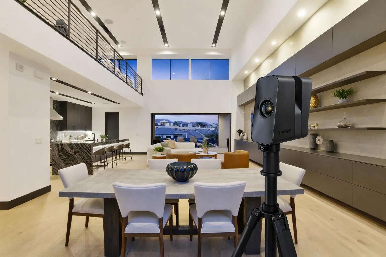
Spatial capture · Baytown, Texas, United States
Matterport Pro3 LiDAR capture and interactive 3D virtual tours give property, construction and facilities teams in Baytown a navigable view of their spaces.
AeroFrohne portfolio totals · all locations
Capture once · use everywhere
AeroFrohne provides Matterport Pro3 LiDAR capture for property marketing, design coordination, construction documentation and facilities operations in Baytown, Texas, United States. A shareable digital twin gives stakeholders a consistent visual record to review remotely.
For projects in Baytown, we plan capture boundaries, site access, scan paths and deliverables around your building and intended use. Tell us the address, approximate floor area, access requirements and schedule so we can confirm availability and scope.
One capture can support remote walkthroughs, progress records, handover documentation and measurement review. We can coordinate naming standards and quality checks across multiple sites, with optional technical outputs agreed before capture.
Scan planning and quality checks help keep the model navigable and consistent. Matterport specifies raw depth accuracy of ±20 mm at 10 m for Pro3; project measurement requirements, site conditions and intended use must be reviewed separately. The extended range of up to 100 m applies to E57 output.
Review room areas, doorway and opening widths, wall runs and floor-by-floor context alongside the tour. These general project examples show Floor 1 at 1,157 ft² and Floor 2 at 1,066 ft². They illustrate measurement views and are not presented as projects completed in Baytown.
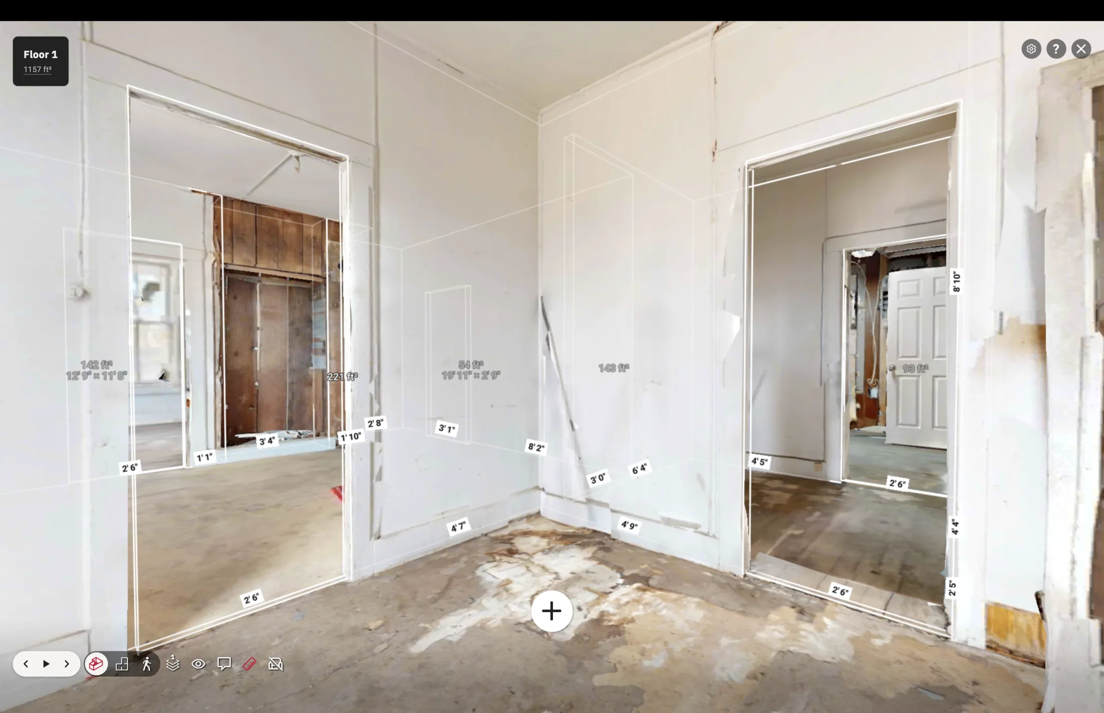
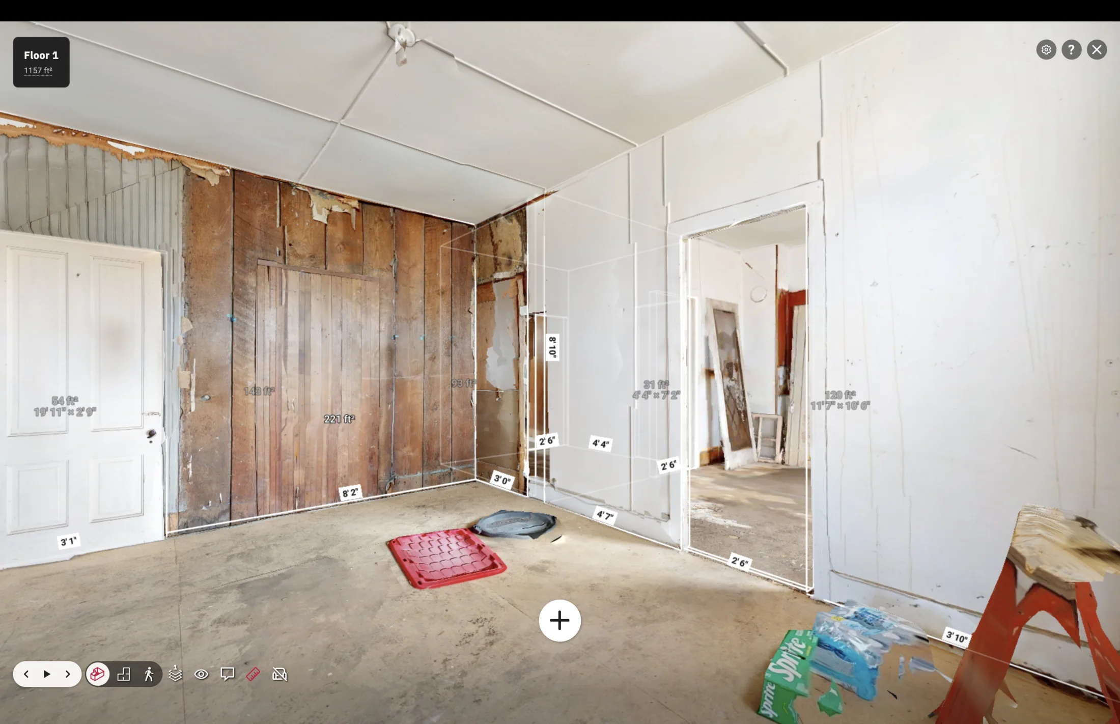
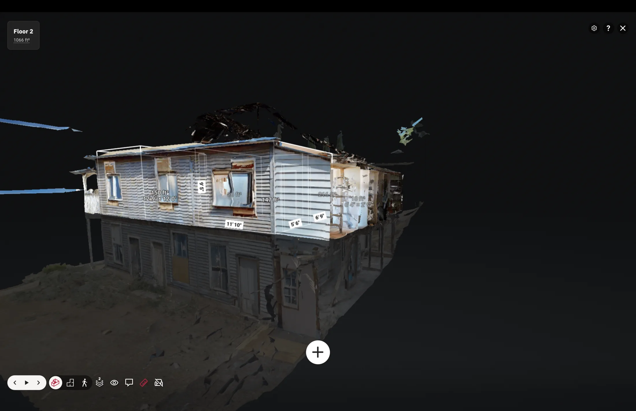
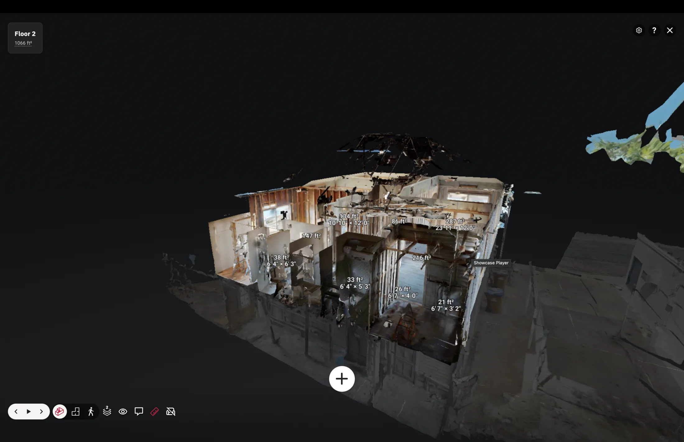
General tour example · project availability in Baytown is confirmed for each address.
Share an interactive, browser-based tour with stakeholders, clients and internal teams for remote review.
Coordinate floor-plan options, room areas, opening dimensions and measurement views appropriate to the agreed scope.
Add context to rooms, assets, issues and handover records with labels, notes and supporting files.
Record progress, existing conditions and pre- or post-renovation spaces for project review.
Use consistent capture requirements, naming and quality checks across a multi-site program.
AeroFrohne's modelers produce Blender and SketchUp 3D models for your architecture projects. CAD, BIM and E57 outputs are also available on request. We confirm file format, level of detail and scope before modeling.
Interactive walkthroughs for listings, hospitality and leasing teams.
Existing-condition records, progress capture and coordination context.
Spatial context for audits, asset records and remote vendor walkthroughs.
Consistent visual documentation for property portfolios and space planning.
Pre- and post-work condition records to support scope discussions.
Visual site records for distributed stakeholders and project documentation.
Confirm the address, objectives, access, capture boundaries, schedule and deliverables.
Complete the agreed on-site Matterport Pro3 capture, subject to site conditions and access.
Review navigation, organize the model and prepare a shareable tour.
Deliver the tour link and coordinate agreed floor plans, exports or technical services.
It provides a navigable visual record of a space for remote walkthroughs, property marketing, project coordination and facilities documentation.
Pro3 supports indoor and outdoor capture. The proposed area, weather, access and connection between scan positions are reviewed when planning the project.
Measurement requirements must be agreed before capture. Tour measurements and raw depth specifications do not by themselves establish survey-grade accuracy or suitability for every construction decision.
Yes. Available exports, modeling requirements, level of detail and file formats are confirmed for each project. These outputs may require additional services.
We can coordinate capture standards, naming conventions and quality reviews for multi-site programs. Availability and scheduling are confirmed for each address.
Send the property address, approximate floor area, preferred dates, access details and required outputs through our contact page. We will review the scope and confirm availability.
Discuss Matterport capture in Baytown, Texas, United States, or explore the related Scan to BIM information for this location.