
Office and tenant improvement
Document suites, circulation, shared areas, and priority wall or opening information before programming, leasing, or interior renovation conversations.
Lake Stevens, Washington
AeroFrohne documents room dimensions, floor areas, wall runs, openings, and floor by floor context for Lake Stevens teams working across homes, multifamily residences, retail suites, workplace interiors, and commercial properties. Give Lake Stevens teams measurement documentation that can inform leasing, due diligence, design review, and visualization decisions. Choose the output that supports the decision: a measurement view, floor plan, CAD package, BIM coordination, or 3D visualization.
Decision ready existing conditions
Start with the rooms, levels, circulation, wall relationships, and openings that matter to your lease, renovation, facilities, design, or acquisition decision.
Lake Stevens property workflows
AeroFrohne supports Lake Stevens homes, multifamily residences, retail suites, workplace interiors, and commercial properties with practical measurement data for design and construction teams. The capture plan should identify the spaces, dimensions, access conditions, and outputs that matter before the technician arrives.
Explore the complete property measurement service →Document suites, circulation, shared areas, and priority wall or opening information before programming, leasing, or interior renovation conversations.
Create a repeatable understanding of unit types, common areas, retail components, and floor-level relationships for portfolio or redevelopment planning.
Give operations, design, and ownership teams a shared spatial reference for layouts, equipment planning, storefront changes, and guest-area discussions.
Document agreed interior spaces, offices, storage areas, doors, and circulation for planning conversations that need an accessible visual record.
Use a defined scope to organize the existing condition information before deeper design, estimating, field verification, or construction documentation begins.
Establish consistent naming, floor context, and room information for ongoing maintenance, space planning, and stakeholder review.
Choose the deliverable
AeroFrohne scopes the deliverable around the necessary tolerance, intended use, file format, and level of documentation—not a generic list of scans.
Organize agreed dimensions and floor by floor areas for remote review, space planning, or property records.
Document wall relationships, doorways, and openings that affect early layout, equipment, or project scope discussions.
Move from measurement context to a static plan or a separately scoped drawing package when the project requires it.
Give leasing, ownership, and project teams a consistent spatial reference before a suite change, fit out, or move.
Use repeatable names, capture priorities, and requested deliverables across multiple Lake Stevens locations.
Translate an existing plan into a visual tool for stakeholder discussions without presenting it as construction documentation.
Clear service boundaries
| Need | Start here | Typical output |
|---|---|---|
| Room, wall, opening, and floor area context | Property Measurements | Measurement views, area summaries, optional plans |
| Editable DWG plans, elevations, or sections | Scan to CAD | CAD drawings and sheet packages |
| Coordinated Revit or IFC model | Scan to BIM | Model and point-cloud coordination |
| Hosted walkthrough and visual context | Matterport 3D Tours | Digital twin, tags, and shareable tour |
Lake Stevens capture brief
For a Lake Stevens property measurement request, a useful brief identifies the address, intended use, floors or suites, desired output, required tolerance, occupancy conditions, building entry instructions, and deadline. That lets the field plan follow the decision instead of collecting unnecessary data.
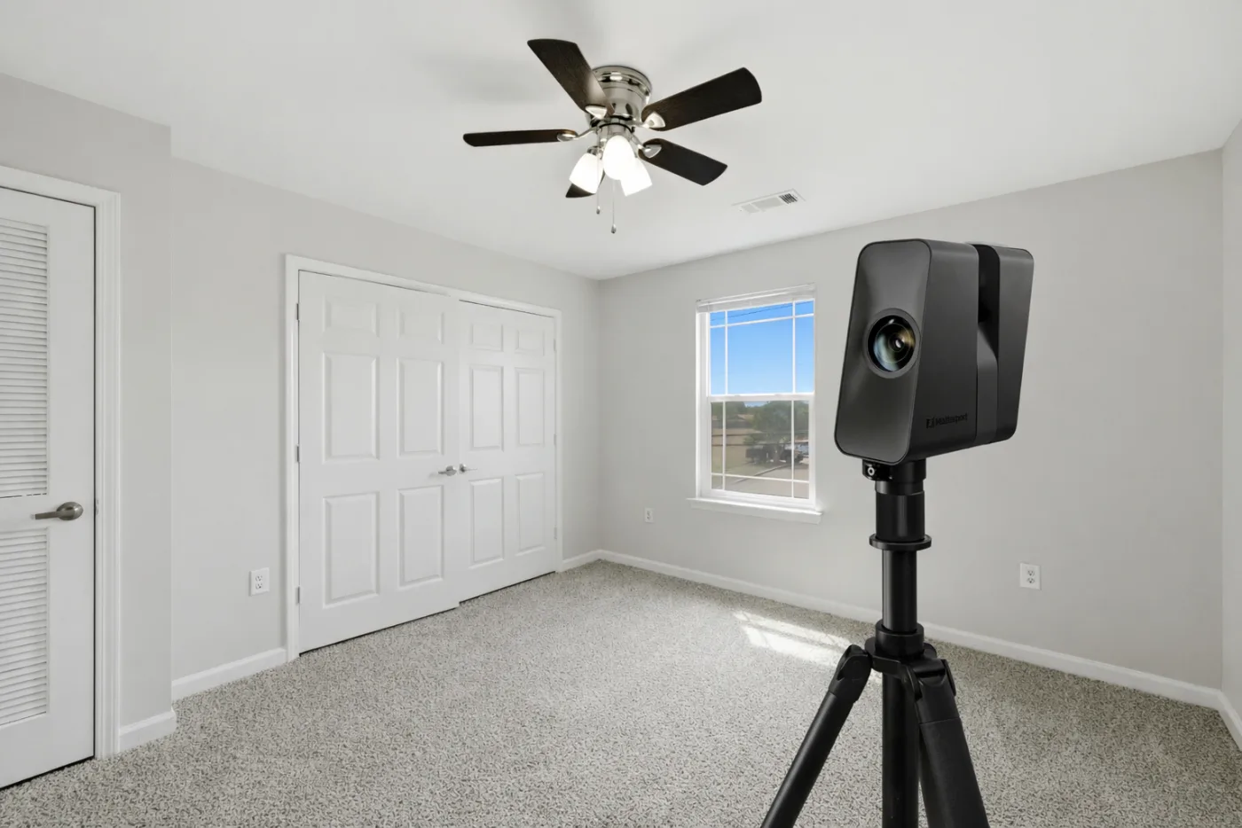
Measurement workflow
Confirm the address, property type, floors, priority spaces, intended use, tolerance, access, and format.
Plan entry, building rules, escort needs, occupancy conditions, loading, and the capture window.
Document the agreed areas, then check coverage, labels, room relationships, and obvious access limitations.
Provide the measurement context, plan, CAD, BIM, or visualization output included in the Lake Stevens project scope.
Frequently asked
Depending on the agreed scope and visibility, AeroFrohne can document room dimensions and areas, wall runs, doorway or opening widths, floor-level area totals, and visual existing condition context.
Yes. Identify every suite, level, common area, and excluded space in the quote request so the capture plan and deliverable structure are clear from the outset.
Yes. A schematic floor plan, a dimensioned drawing, a CAD sheet, and a BIM model are distinct deliverables. AeroFrohne can scope the appropriate output after reviewing the use case.
Include your preferred contact, entry and loading details, security requirements, access hours, escort needs, and any occupied or restricted spaces when you request the quote.
No. This service documents agreed building interiors and spaces. Legal boundaries, easements, ALTA or NSPS work, and regulated survey deliverables require the appropriate licensed professional scope.
Ready to scope Lake Stevens measurements?
Include the Lake Stevens address, property type, approximate size, number of levels, areas to capture, priority measurements, intended use, access notes, desired format, and deadline.
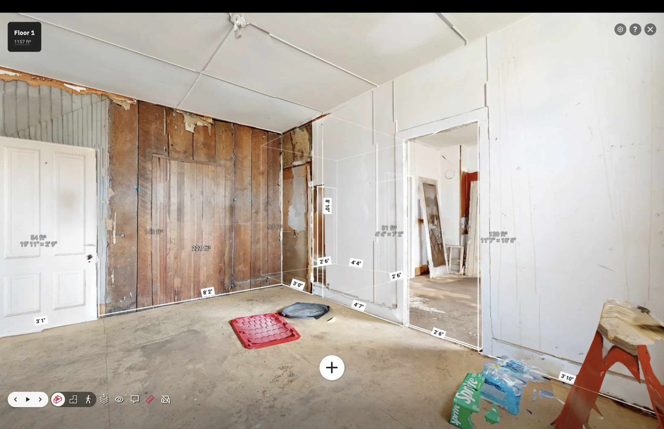
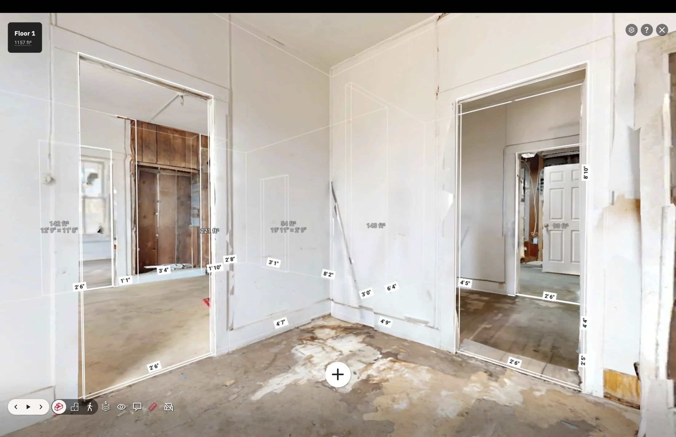
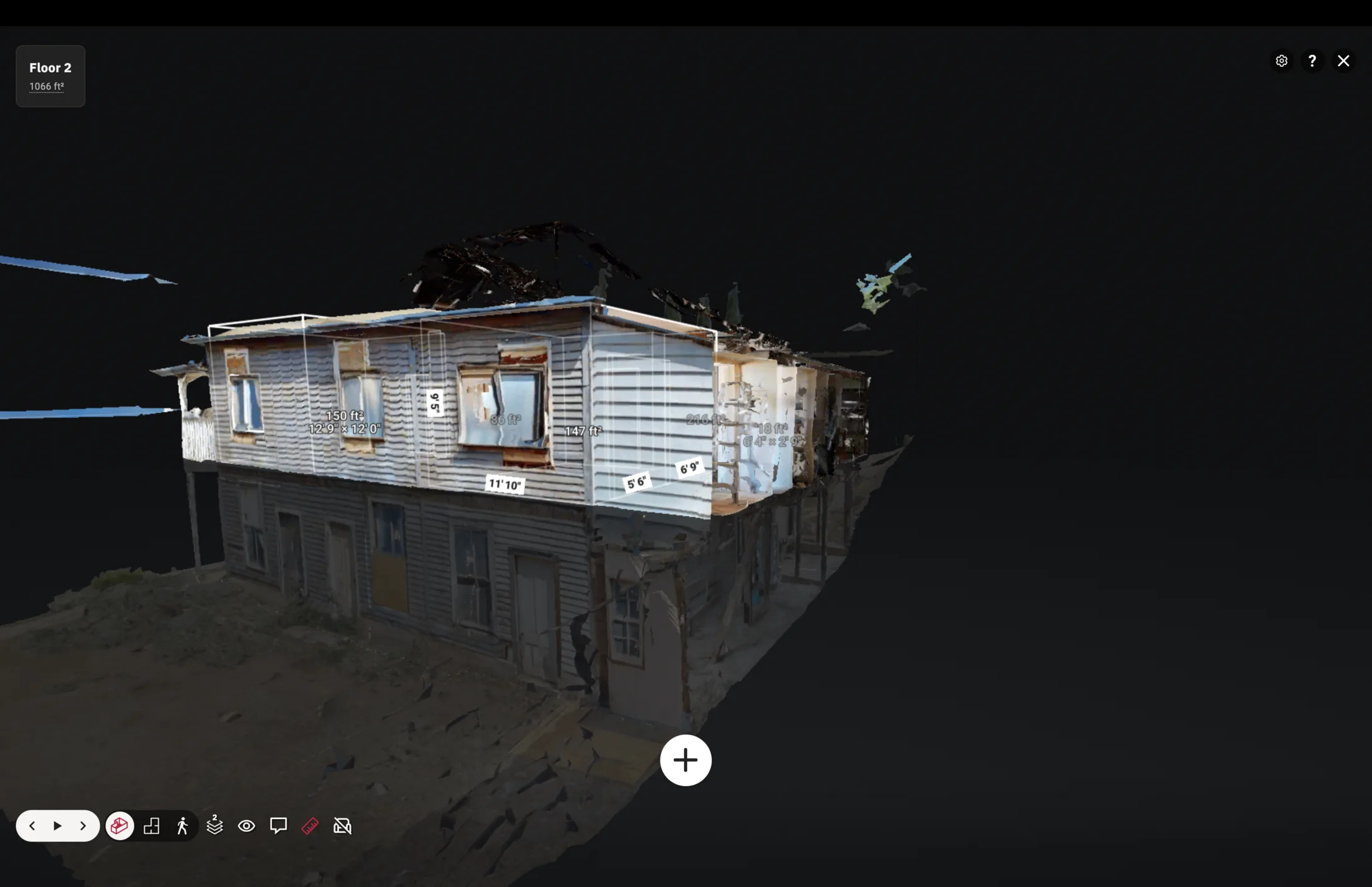
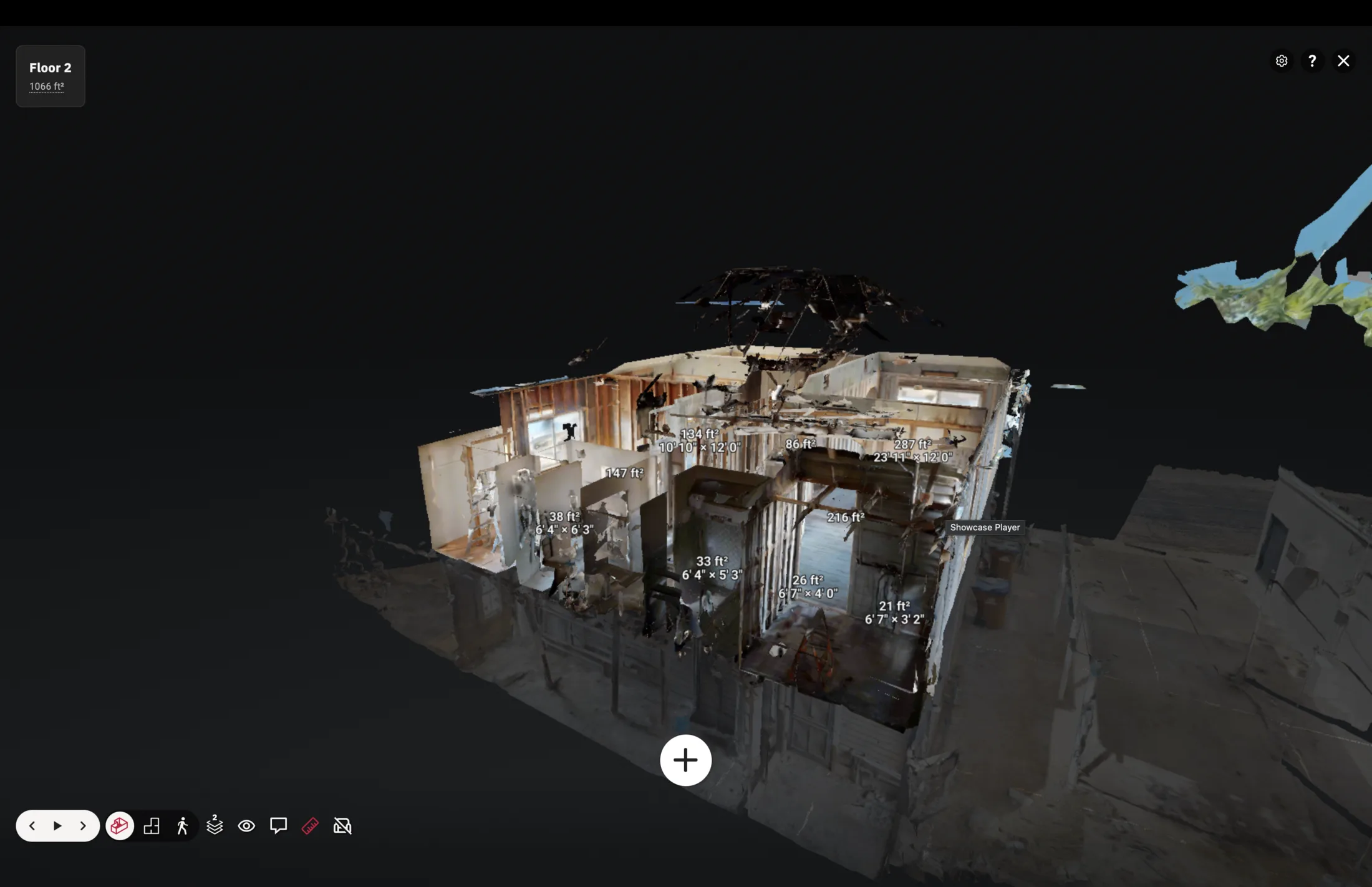
Lake Stevens measurement visuals
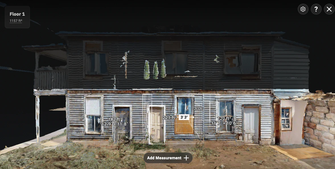
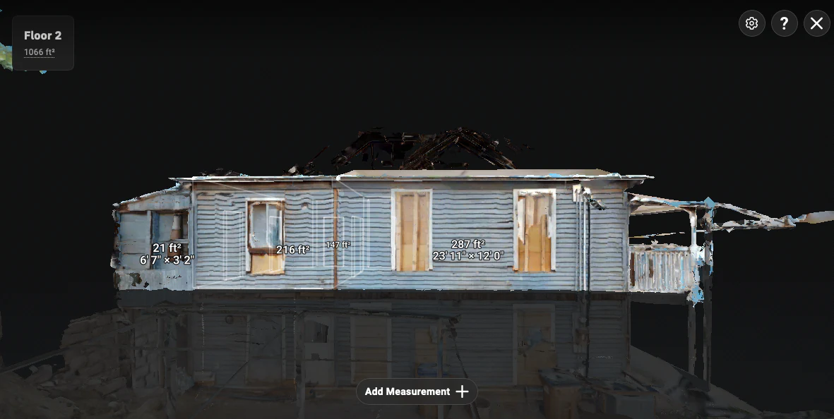
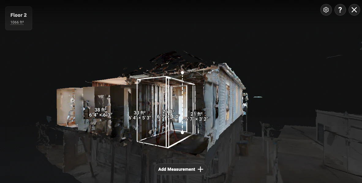
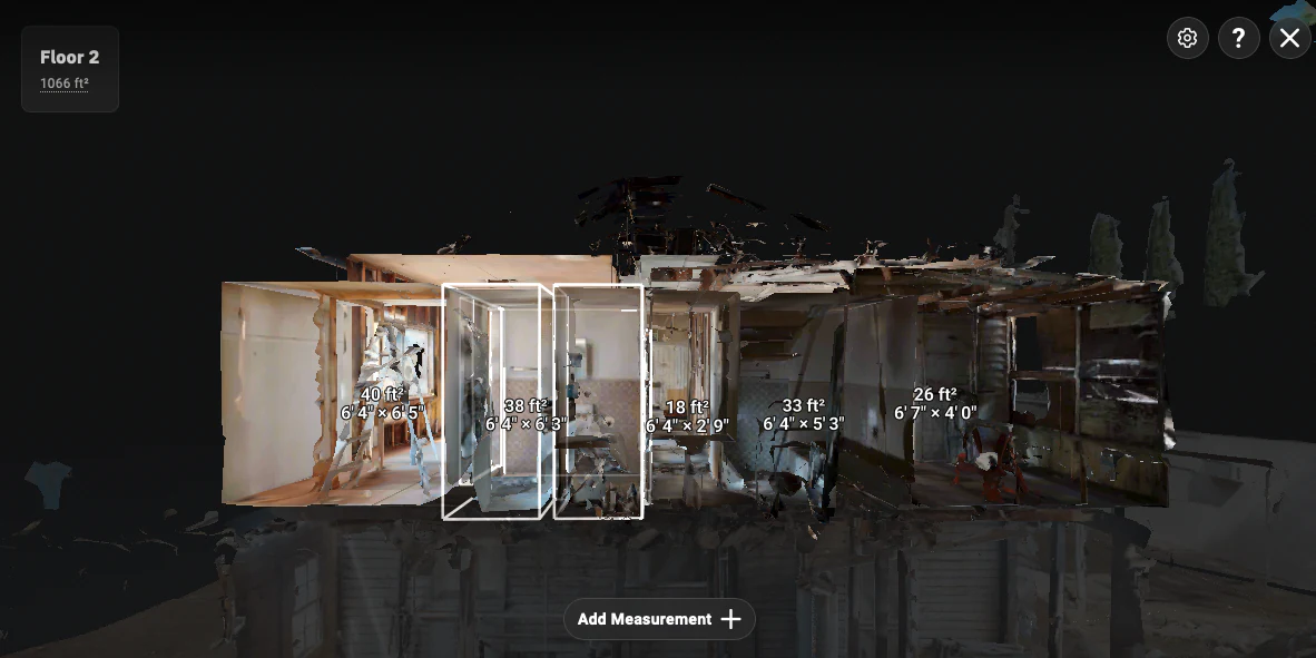
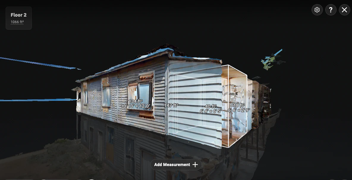
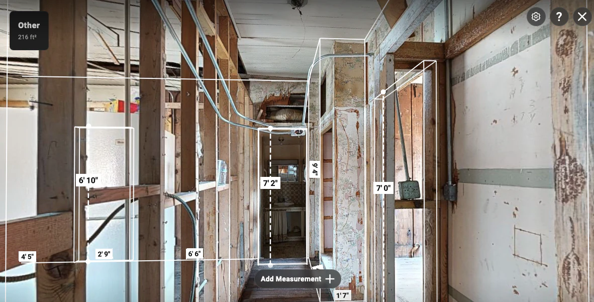
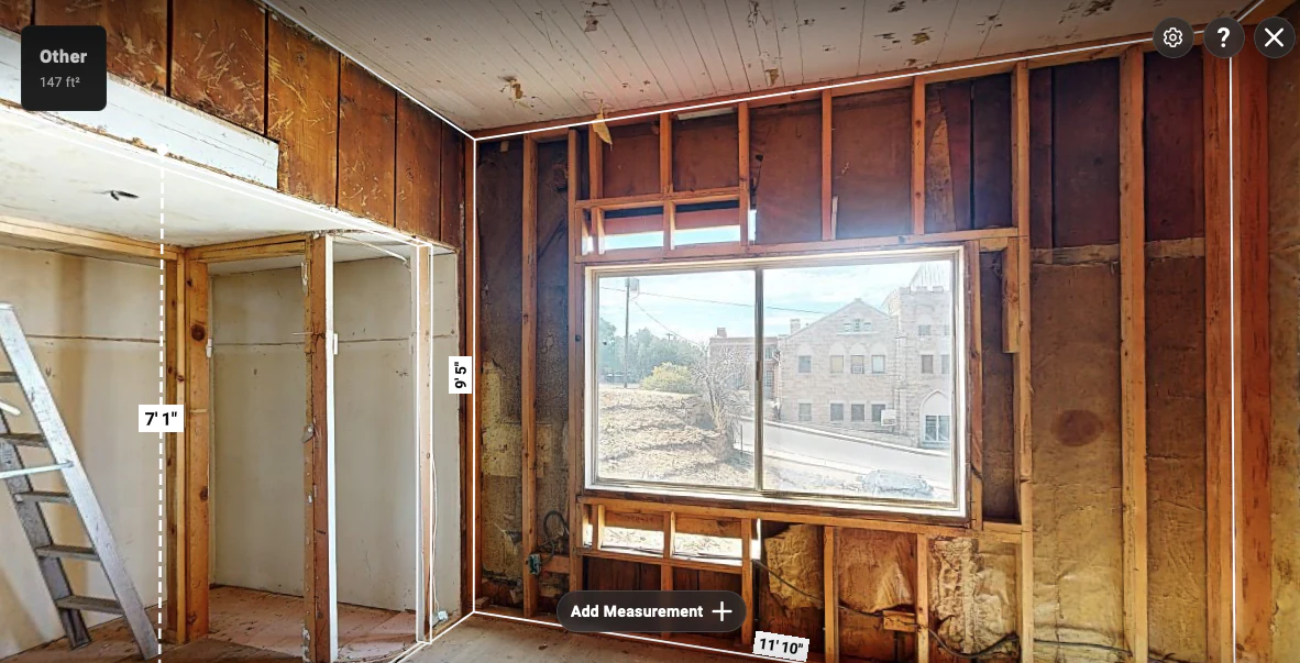
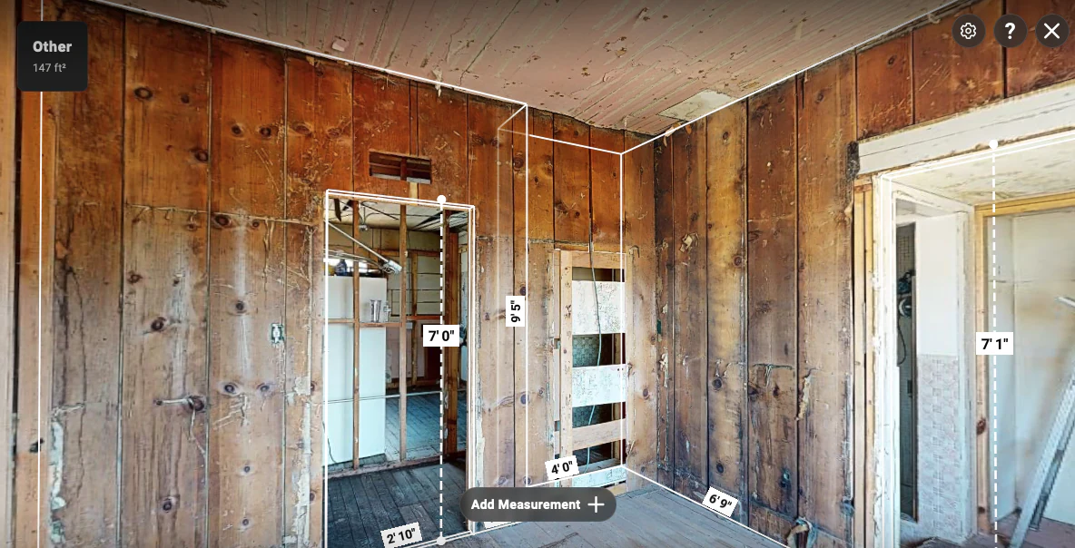
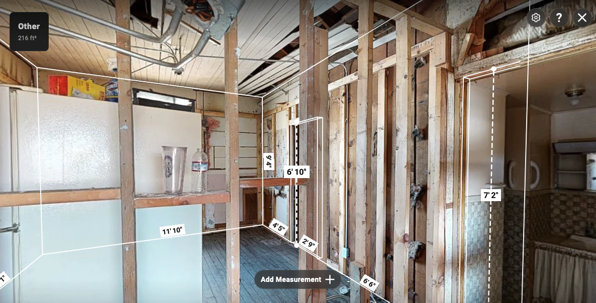
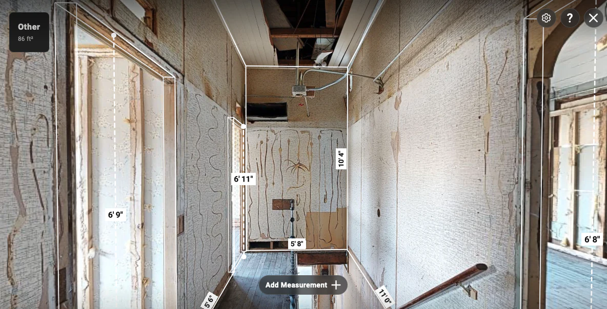
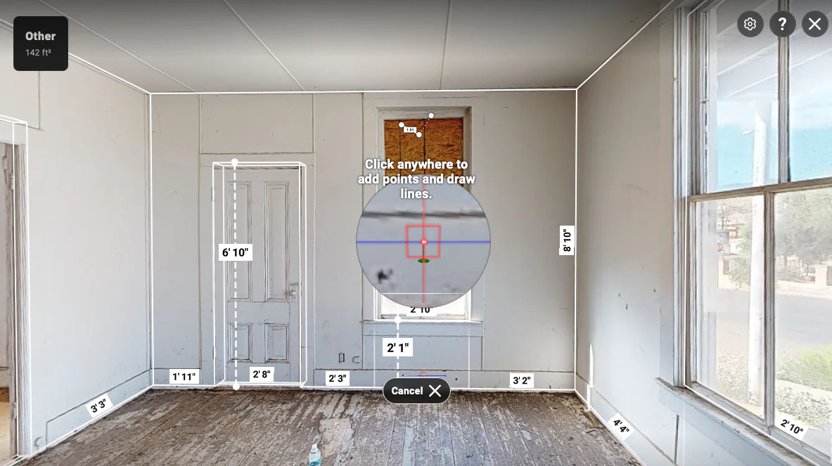
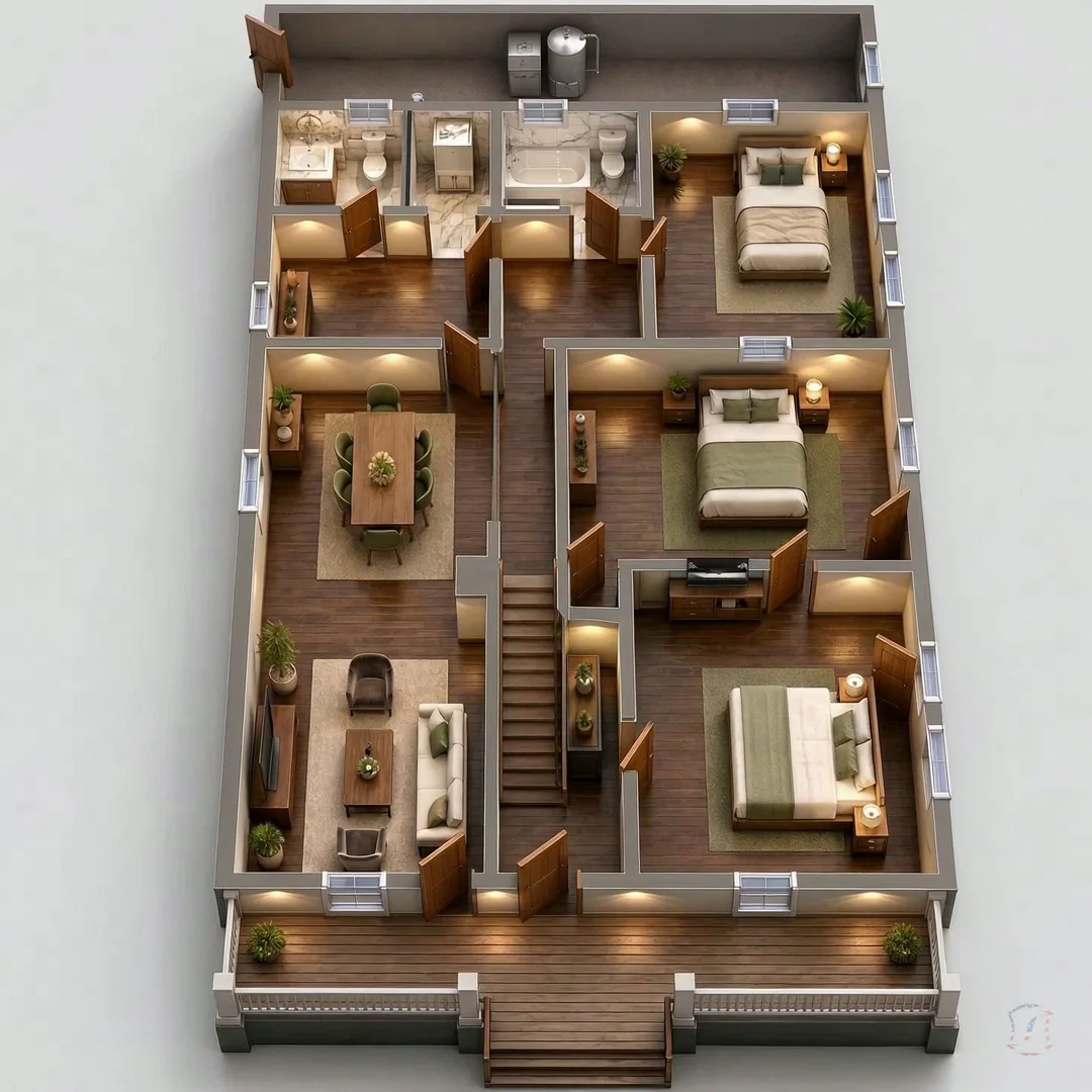
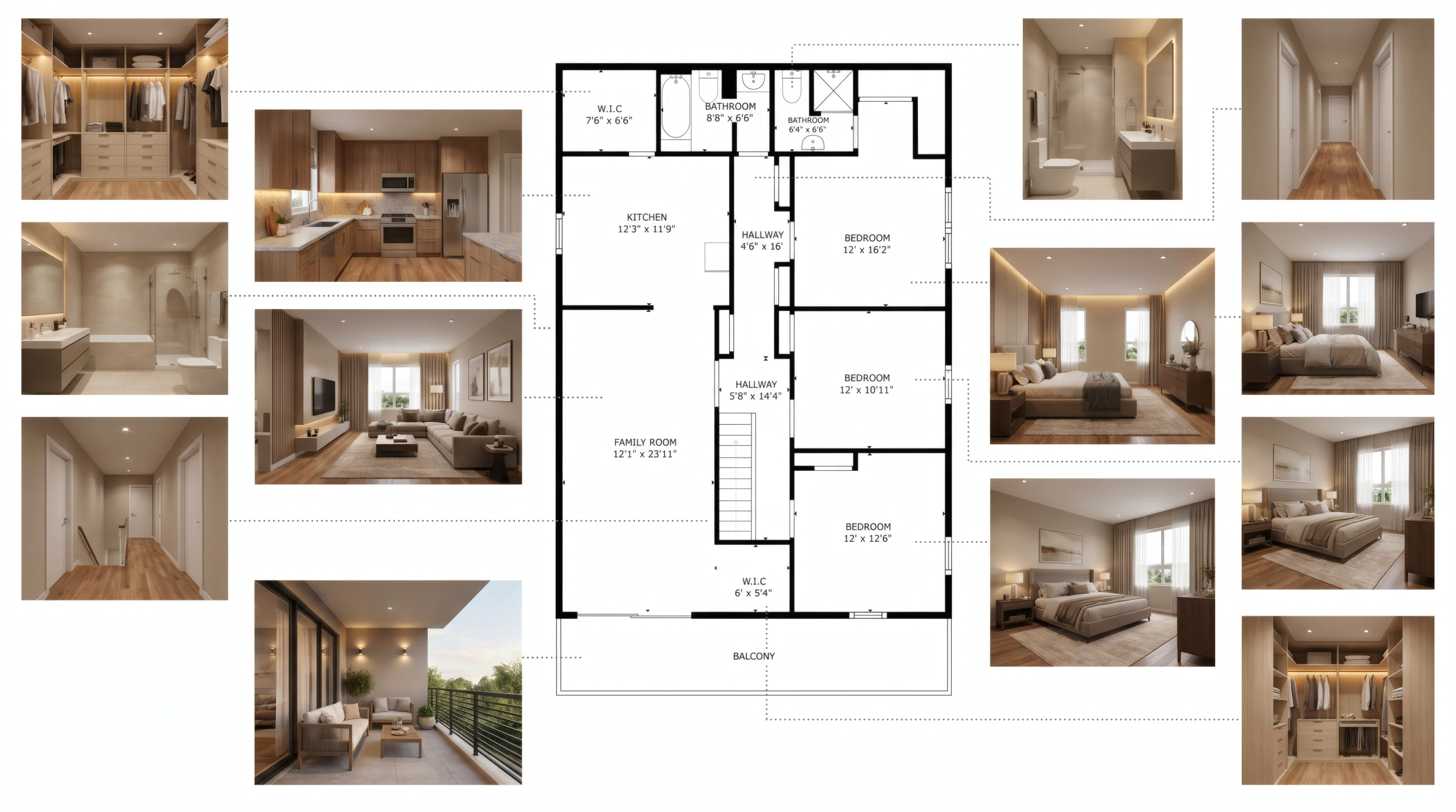
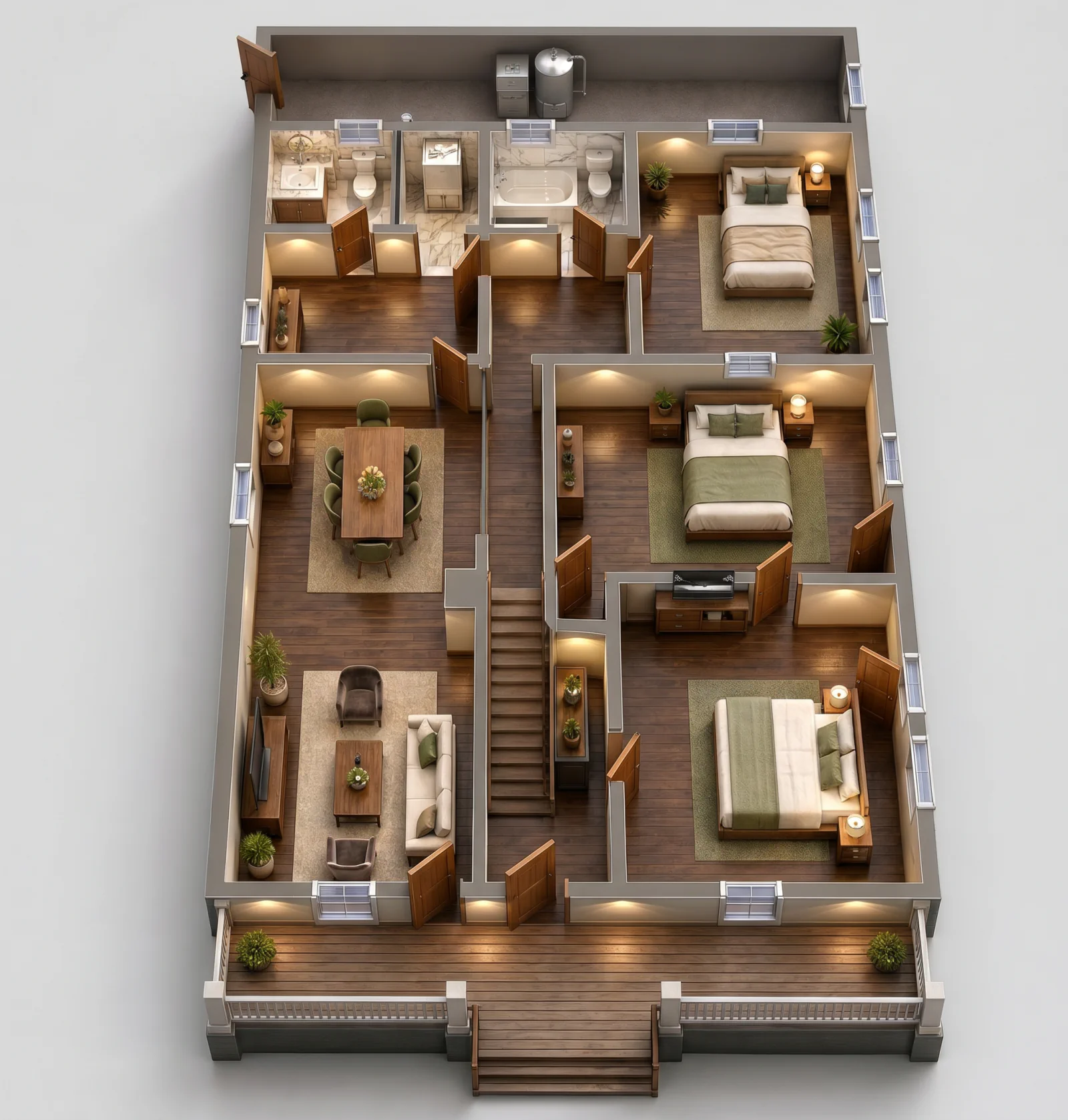
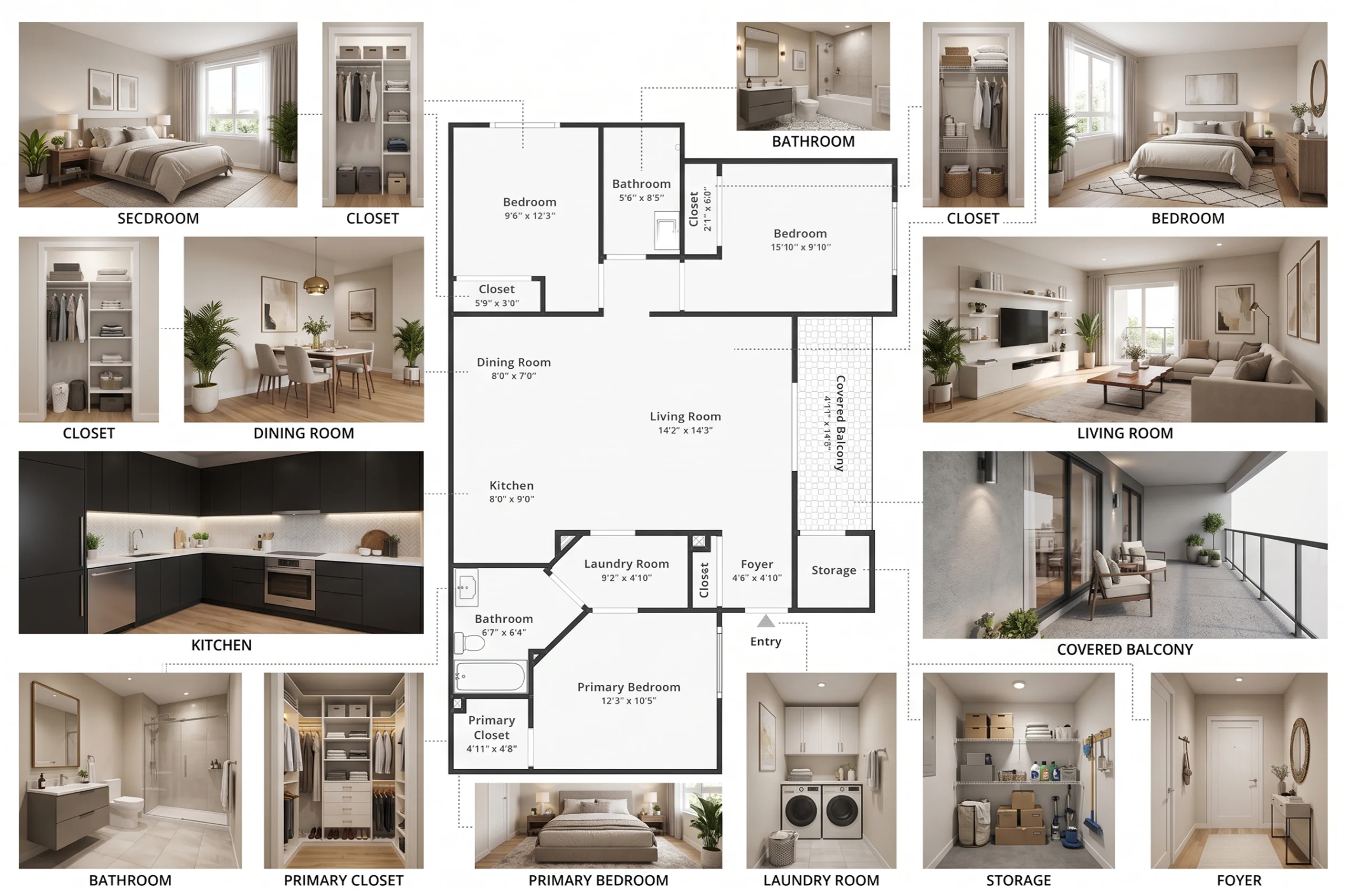
These examples show how room areas, floor context, circulation, wall runs, and openings can be communicated after an agreed Lake Stevens capture. They illustrate the available views; the property, access plan, accuracy requirements, and deliverable remain project specific.
Explore the complete property measurement service →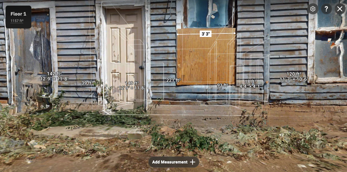
Lake Stevens roof measurement reporting
A roof report can bring geometry, areas, slopes, linear edges, and takeoff assumptions together for a Lake Stevens project brief. The sample images below illustrate deliverable structure; each property’s access, condition, verification needs, and handoff are scoped individually.
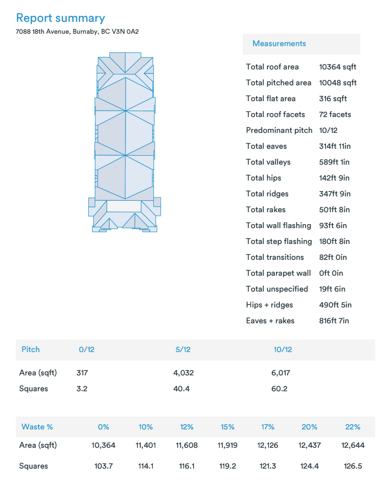
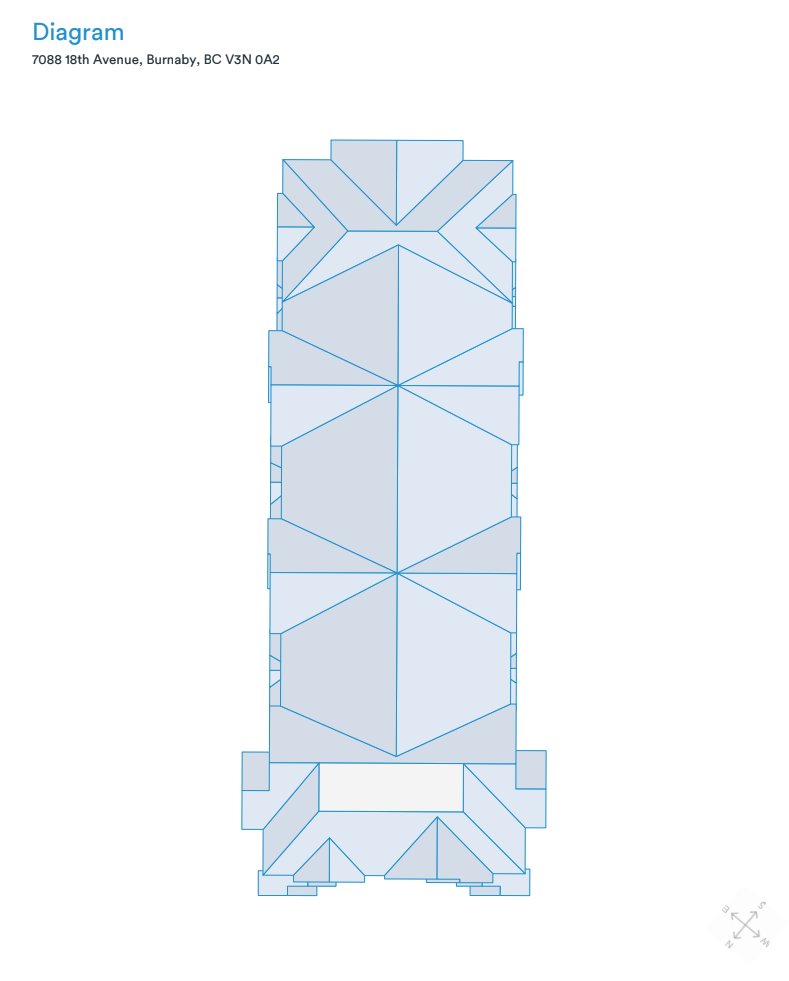
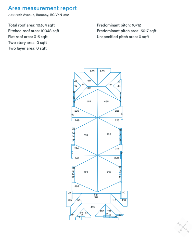
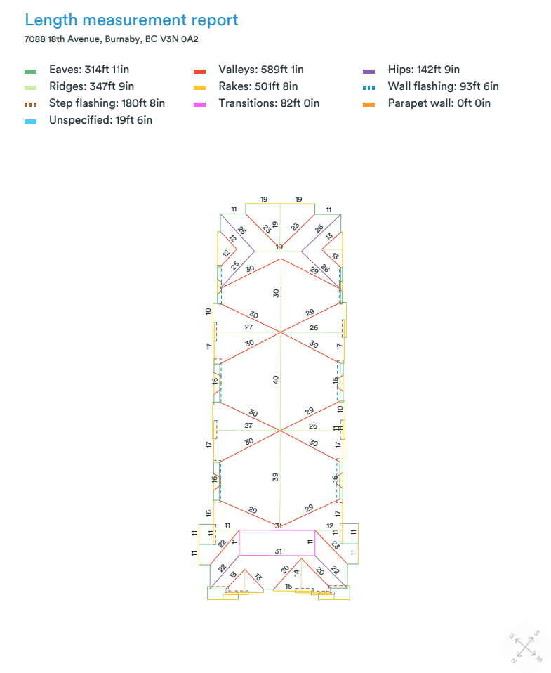
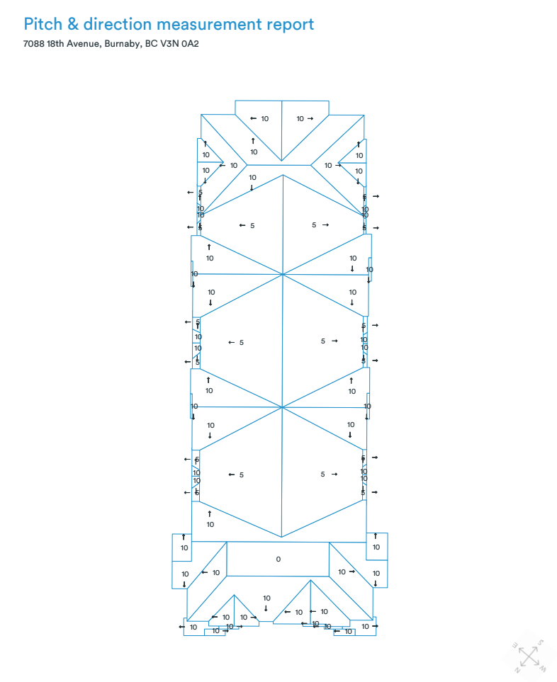
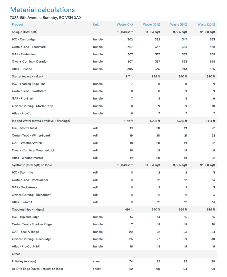
Sample report pages illustrate output types only. Lake Stevens roof scope, site conditions, field verification, estimates, code requirements, and construction decisions require project specific review.
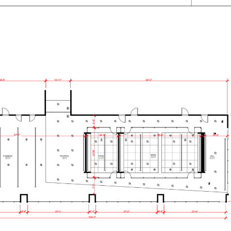
Optional CAD handoff
When the next decision requires more than visual measurement context, AeroFrohne can scope a Lake Stevens Scan to CAD handoff with the agreed plans, dimensions, formats, layers, and verification expectations.
Lake Stevens plan communication
Illustrative 3D plan visuals can help leasing, renovation, owner, and stakeholder conversations. They are scoped separately from measurement documentation and should match the intended audience and decision.
Lake Stevens measurement to 3D video
This short animation shows an illustrative path from a documented 2D layout to a furnished top down visualization. It can help Lake Stevens owners, renovation teams, and leasing stakeholders discuss spatial relationships before the next design or construction decision.