Google Maps Integration in San Antonio
Serving San Antonio, Texas and the Hill Country, AeroFrohne produces 2D orthomosaic maps georeferenced, distortion corrected aerial imagery created from high resolution Drone and Airplane capture.
We integrate these high fidelity maps directly into Google Maps, Google Earth, and CAD/GIS systems, replacing outdated satellite imagery of Bexar County with crystal clear, current data for construction sites, quarries, developments, and ranches.
Resolution Comparison
Satellite vs. Drone Orthomosaic
See the difference between standard Google Earth satellite imagery and AeroFrohne's real time, sub-inch resolution drone capture.
The Clarity Advantage
- Resolution: Up to 100x higher detail than standard satellite data.
- Recency: Capture "live" site conditions in San Antonio instantly.
- Integration: We tile these images directly over Google Maps using GeoTIFF overlays.
- Readability: Clearly see fence lines, utility covers, and pavement cracks.
Drone vs. Airplane Mapping
| Feature | Drone Orthomosaic (Low Altitude) | Airplane Ortho (High Altitude) |
|---|---|---|
| Ideal Project Size | Under 500 Acres (Construction, Campuses, Quarries) | 500 - 100,000+ Acres (Cities, Pipelines, Ranches) |
| Resolution (GSD) | Ultra High (0.5 cm - 2cm per pixel) | High (3" - 6" per pixel) |
| Deployment Speed | Rapid (24-48 hours in San Antonio area) | Planned (Requires flight plans/ATC/FAA Authorization) |
| Google Maps Overlay | High Zoom Detail (See assets & equipment) | Regional Context (See roads & terrain) |
Why invest in Google Maps visibility
Reduce visitor friction and increase trust. It improves wayfinding for multi-building sites in San Antonio and gives prospective customers a clear preview before they arrive.
Capture + compliance + publishing
AeroFrohne provides end to end capture, processing, and publishing support, ensuring full compliance with local airspace regulations near SAT airport and military bases.
Industries Served in Central Texas
Construction & Civil
Construction orthomosaic mapping provides a consistent aerial baseline for project coordination in fastngrowing San Antonio:
• Progress tracking (weekly/biweekly capture)
• As-built site documentation and reporting
• Earthwork visibility and scope verification
• Faster stakeholder alignment with a single ground truth map
Aggregates & Mining
Orthomosaic mapping helps teams manage quarries, stockpiles, and logistics routes along the Balcones Fault Zone:
• Stockpile volume measurements and tracking
• Site layout context for safety and access planning
• Documentation for environmental compliance
• Stakeholder-ready visuals for reporting
Hill Country Ranches
Orthomosaics provide clear property context for owners and land managers across the Hill Country:
• Property visibility for access roads, water features, and fencing
• Planning support for improvements and maintenance
• Shareable maps for vendors and stakeholders
• Consistent records of change over time (drought/flood impact)
Commercial Development
Real Estate orthomosaics support site selection and marketing for new developments in Bexar and Comal counties:
• Site visibility for investors and partners
• Context for road access and utility planning
• High resolution marketing assets for pre-sales
• Current imagery replacing outdated satellite data
Solar & Renewables
Orthomosaics enable rapid site understanding for EPC and O&M workflows in Central Texas:
• Construction progress and site logistics visibility
• Access road and drainage context
• Post-event documentation (storm/hail impacts)
• Portfolio consistency across multiple sites
Public Sector & Campuses
Campus orthomosaic mapping supports planning for universities, hospitals, and municipal sites in San Antonio:
• Facilities planning and vendor coordination
• Documentation for public works
• Improved communication for stakeholders and boards
• Repeatable baselines for long term asset tracking
AeroFrohne supports nationwide orthomosaic mapping through travel ready teams, serving San Antonio and the greater Texas region.
Google Maps Integration
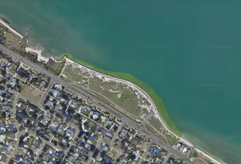
Example: Integrated aerial view of a development site.
Common Questions
What is Google Maps integration?
It is the process of capturing high quality drone orthomosaic imagery and publishing it so users can explore a location directly inside Google Maps.
Do you handle capture and publishing?
Yes. AeroFrohne provides end to end capture, processing, and publishing support. We handle all airspace authorizations for San Antonio (SAT), Kelly Field, and surrounding areas.
How long after processing will my map appear in Google Maps?
Typically between 4 to 5 months for full drone ortho to satellite layer updates.