Do you provide land surveying services in Texas?
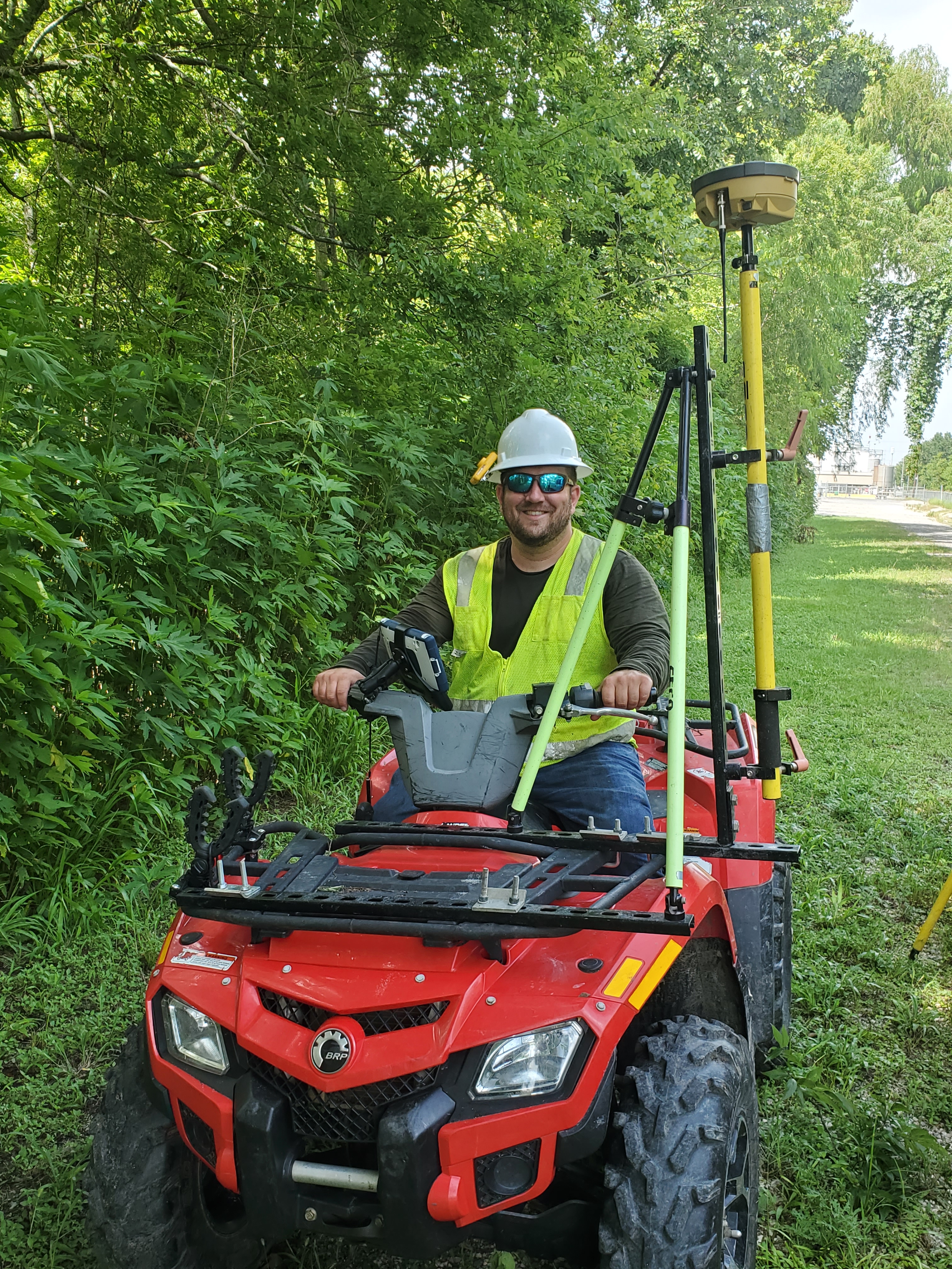
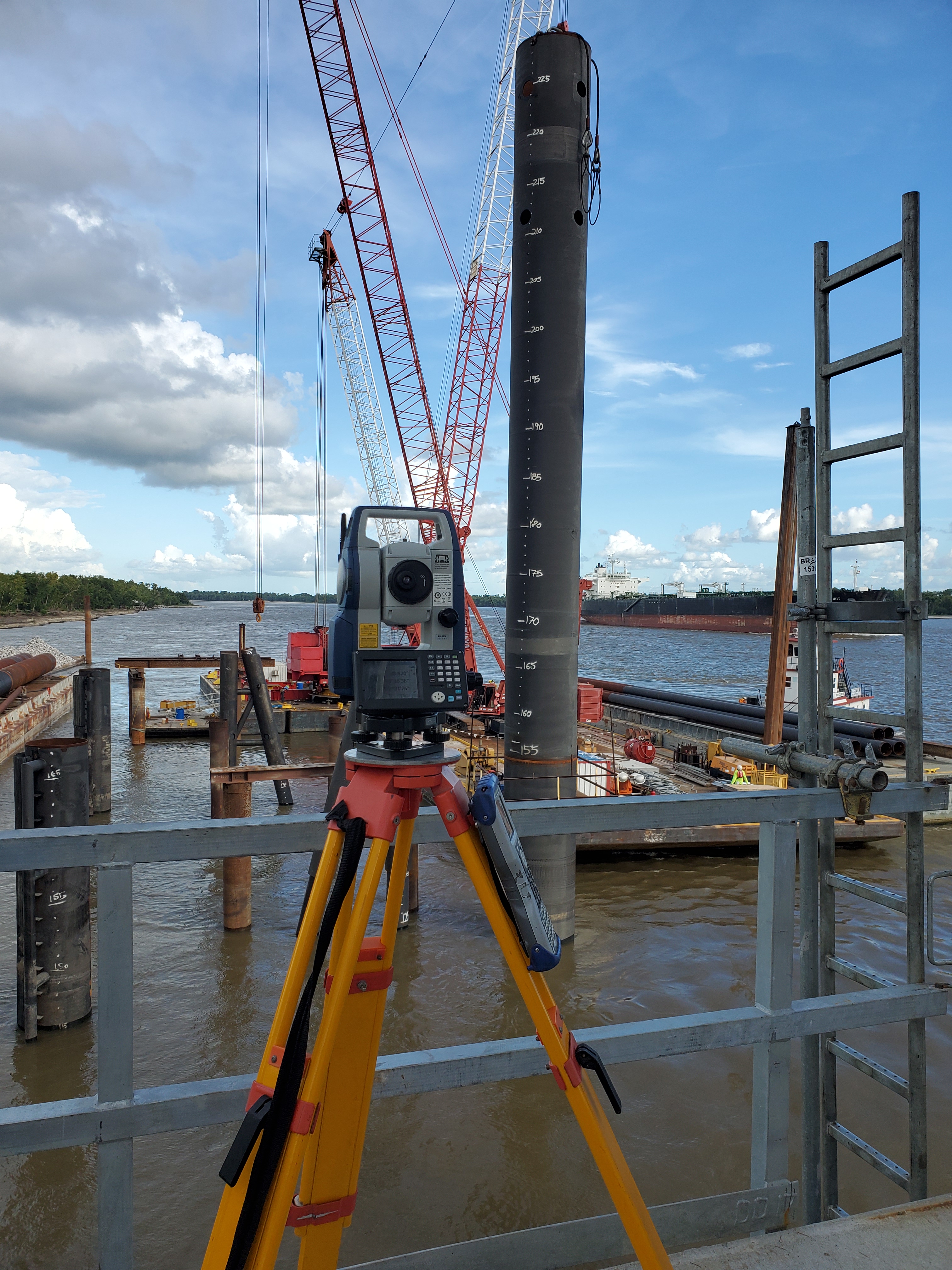
Yes. Texas land surveying services are coordinated through Davis Family Surveying (DFS) LLC, TBPELS Firm Registration No. 10195037, with AeroFrohne reality capture support for point clouds, drone mapping, site visualization, engineering coordination, and technical media.
What survey deliverables can I request?
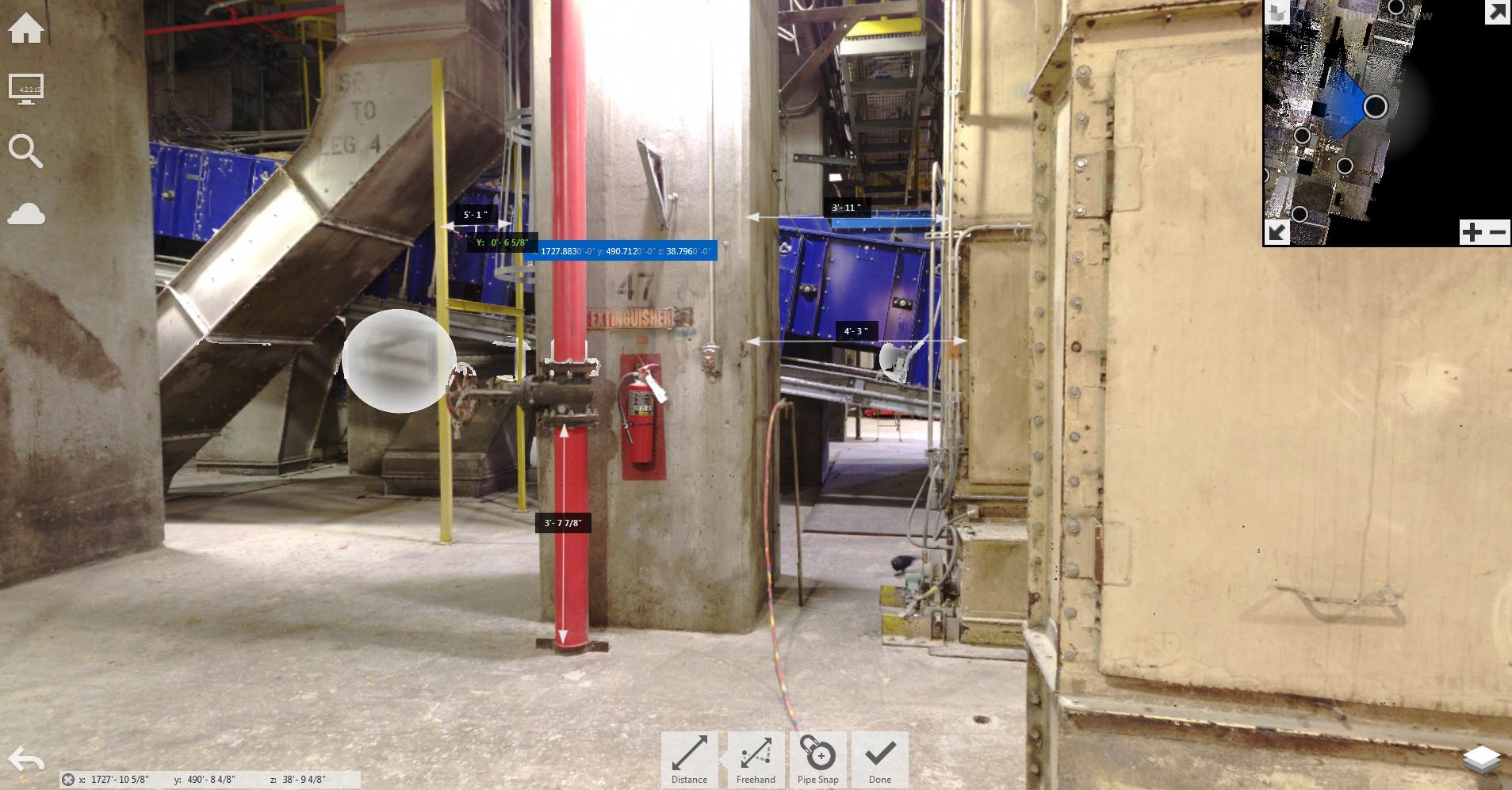
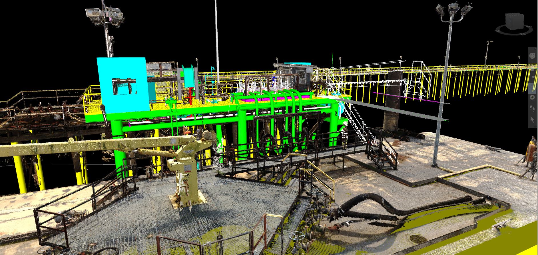
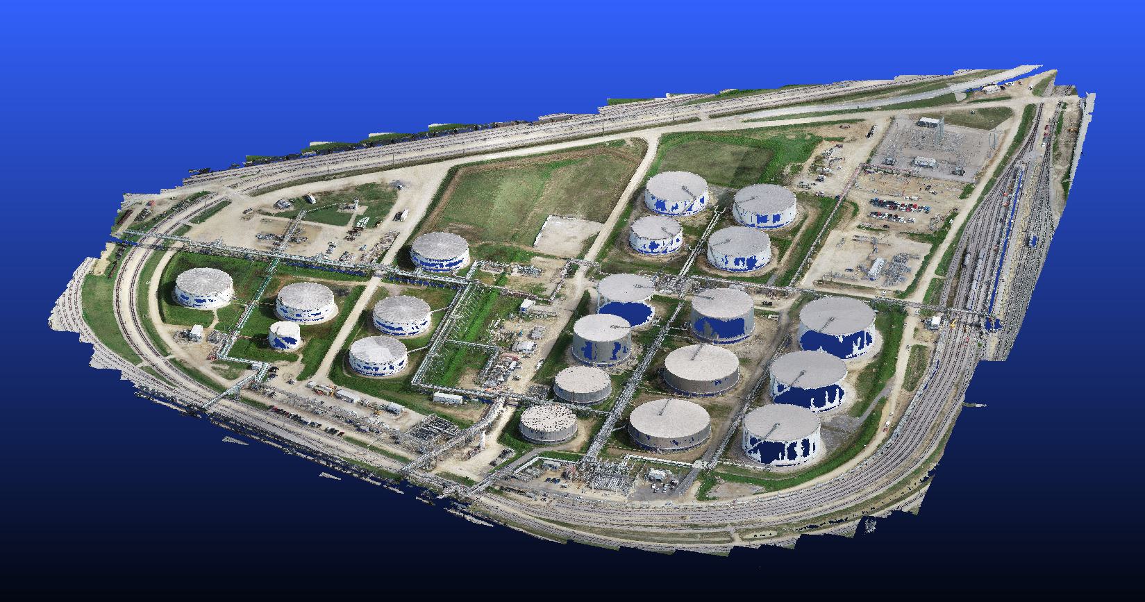
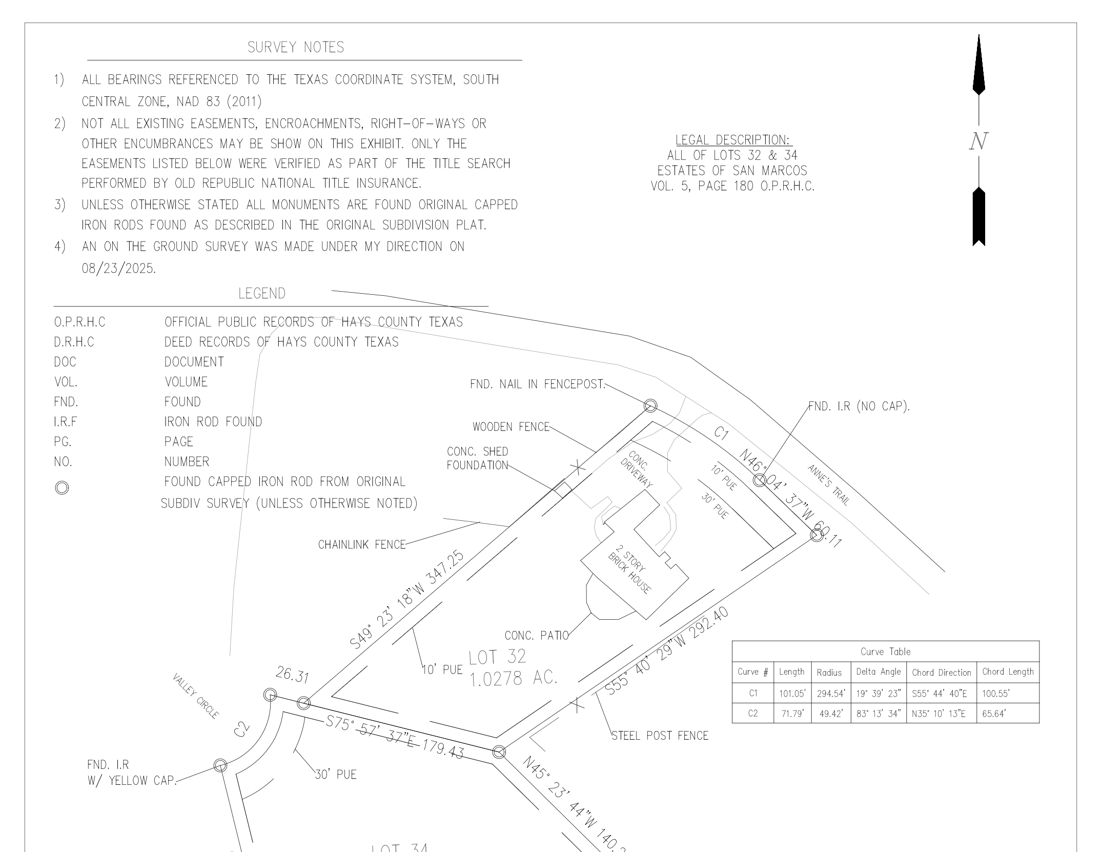
Typical deliverables may include boundary surveys, ALTA/NSPS land title surveys, topographic surveys, easement exhibits, right-of-way mapping, construction staking files, as-built survey data, CAD linework, contours, surfaces, and point cloud coordination when requested.
Can survey data be coordinated with civil engineering design?
Yes. Survey data can be organized for civil design teams, architects, developers, contractors, and infrastructure stakeholders using CAD, point cloud, surface, and site reference deliverables.
Can AeroFrohne combine surveying with drone mapping or LiDAR?
Yes. AeroFrohne can add drone mapping, terrestrial LiDAR, 360 documentation, inspection media, and point cloud capture to support the licensed survey workflow and improve project context.
What files should I send to start?
Send the site address, parcel ID, title commitment if available, existing plans, requested survey type, access instructions, deadline, and preferred deliverables such as PDF, DWG, surface, point cloud, or staking files.
Is this page targeted only to Texas?
Yes. This land surveying page is targeted to Texas projects so the content, licensing context, and search visibility stay aligned with the intended jurisdiction.