
Scan to BIM in Piastów turns measured visible building conditions into Revit, IFC and CAD documentation.
Scan to BIM Piastów, Poland
Small-site renovation geometry
Small-site renovation geometry
For a compact renovation site in Piastów, establish which external elevations and internal connections actually affect the proposed work. Walls close to neighbouring structures may be difficult to observe, so record visibility limitations instead of completing the model with unsupported geometry.
Prepare before quoting
Identify accessible external viewpoints and boundary-adjacent walls; distinguish building documentation from a separate boundary survey.
Agreed Scan to BIM deliverables
Revit RVT and IFC
Architectural, structural and visible MEP models to an agreed LOD 200–300 scope. Specify required families, naming and Revit version.
E57 point cloud
Registered measured data as a reference. Agree file segmentation, the coordinate system and documentation of areas outside measured coverage.
DWG and PDF drawings
Plans, elevations and sections selected for the designer’s needs. Supply sheet templates, drawing scales and layer standards before production.
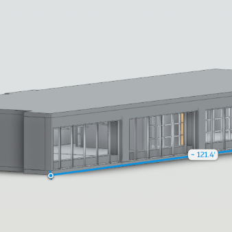
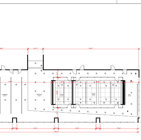
Sample capture deliverables
These illustrations show AeroFrohne’s general workflow, not a completed project in this location.
From scope to acceptance
- Provide the address, area in m², floors, intended model use and deadline. Include existing drawings and the access plan.
- Agree capture, registration, tolerance and verification. Technician availability and scheduling are confirmed for the project.
- Receive a model checked against the point cloud, with agreed files and a record of gaps and assumptions.
Piastów Scan to BIM questions
How should I brief a project in Piastów?
Identify accessible external viewpoints and boundary-adjacent walls; distinguish building documentation from a separate boundary survey.
Which files can I request?
Depending on the agreement: native Revit RVT models, IFC exchange models, registered E57 point clouds, and DWG or PDF plans, elevations and sections. Define the software version and required elements before quoting.
Does LOD specify measurement accuracy?
No. LOD 200 or 300 describes the agreed model development scope. Tolerance, checking methods, reference system and acceptance criteria are agreed separately for the project. Hidden or inaccessible elements require additional evidence.
Is a local team available in Piastów?
AeroFrohne is headquartered in Corpus Christi, USA. Field capture availability is confirmed for the specific address, scope and schedule. This page describes project coverage and does not represent a staffed local office.
Other locations around Warszawa
Warszawa · Ząbki · Zielonka · Marki · Kobyłka · Wołomin · Sulejówek · Legionowo · Pruszków · Ożarów Mazowiecki · Łomianki · Izabelin · Stare Babice · Raszyn · Michałowice · Nadarzyn · Piaseczno · Józefosław · Konstancin-Jeziorna · Józefów · Otwock · Karczew · Radzymin · Nieporęt · Serock · Błonie · Brwinów · Milanówek · Podkowa Leśna · Grodzisk Mazowiecki · Żyrardów · Nowy Dwór Mazowiecki · Góra Kalwaria · Halinów · Wiązowna · Leszno · Celestynów