
Floor plans and ceiling plans
Specify plan cut height, room boundaries, openings, fixed features and visible ceiling elements. Supply a DWG template, layer standard and required annotation language.
Badia Polesine, Veneto, Italy
Turn registered 3D capture or suitable supplied point clouds into the agreed existing-condition drawings. Define the drawing set, units, cut levels and checking criteria before drafting.
Company-wide AeroFrohne statistics from the homepage; these are not totals for this city. Project dimensions and areas can be delivered in metres and m².
Badia Polesine, Veneto, Italy. Turn registered 3D capture or suitable supplied point clouds into the agreed existing-condition drawings. Define the drawing set, units, cut levels and checking criteria before drafting.
AeroFrohne is headquartered in Corpus Christi, Texas, USA. Field capture availability, technician coordination, travel, access and schedule are confirmed for the specific address and scope. This location page does not represent a staffed local office.
This page refers to Badia Polesine in Provincia di Rovigo, Veneto, Italy. Include the street, building and unit identifiers so the project team can distinguish this locality from places with similar names. For the CAD brief, mark the floors, façade sides and section lines required for the design decision. State drawing units, plan cut heights, sheet scales, layer conventions and annotation language. Identify adjoining properties and surfaces that should remain outside the drawing scope, and provide any existing DWG files for an alignment review.
Locality reference: Badia Polesine; Provincia di Rovigo, Veneto, Italy. Gazetteer point: 45.09508, 11.49443. This identifies the named place, not a surveyed building, cadastral boundary or project coordinate control. Check the locality record and confirm the property address when requesting a quote. Check the GeoNames locality reference · CC BY 4.0
Specify plan cut height, room boundaries, openings, fixed features and visible ceiling elements. Supply a DWG template, layer standard and required annotation language.
Choose façade sides and section lines around design decisions. Agree reference levels, linework simplification and how obscured or unmeasured surfaces are identified.
Agree sheet sizes, drawing scales and revision labels. Request registered E57 data separately if the team needs the measured reference alongside the drawings.
The images and downloadable model are examples of AeroFrohne’s general workflow, not claims of a completed project at this location.
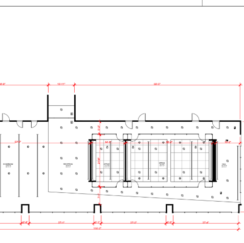
This page refers to Badia Polesine in Provincia di Rovigo, Veneto, Italy. Include the street, building and unit identifiers so the project team can distinguish this locality from places with similar names. For the CAD brief, mark the floors, façade sides and section lines required for the design decision. State drawing units, plan cut heights, sheet scales, layer conventions and annotation language. Identify adjoining properties and surfaces that should remain outside the drawing scope, and provide any existing DWG files for an alignment review.
Floor plans and ceiling plans: Specify plan cut height, room boundaries, openings, fixed features and visible ceiling elements. Supply a DWG template, layer standard and required annotation language. Elevations and sections: Choose façade sides and section lines around design decisions. Agree reference levels, linework simplification and how obscured or unmeasured surfaces are identified. PDF sheets and point-cloud references: Agree sheet sizes, drawing scales and revision labels. Request registered E57 data separately if the team needs the measured reference alongside the drawings.
Confirm DWG version, metres or millimetres, layer names, linework, cut heights, sheet scales, reference levels and how existing drawings should be aligned. Identify dimensions that need installation or fabrication checks.
No. DWG plans, a registered point cloud and a Revit or IFC model are distinct deliverables. Select the outputs required for the next project decision so the proposal and review criteria match the intended use.
AeroFrohne is headquartered in Corpus Christi, Texas, USA. Field capture availability, technician coordination, travel, access and schedule are confirmed for the specific address and scope. This location page does not represent a staffed local office.