Land surveying for Mexico

Land Surveying in Ario de Rosales, Michoacán

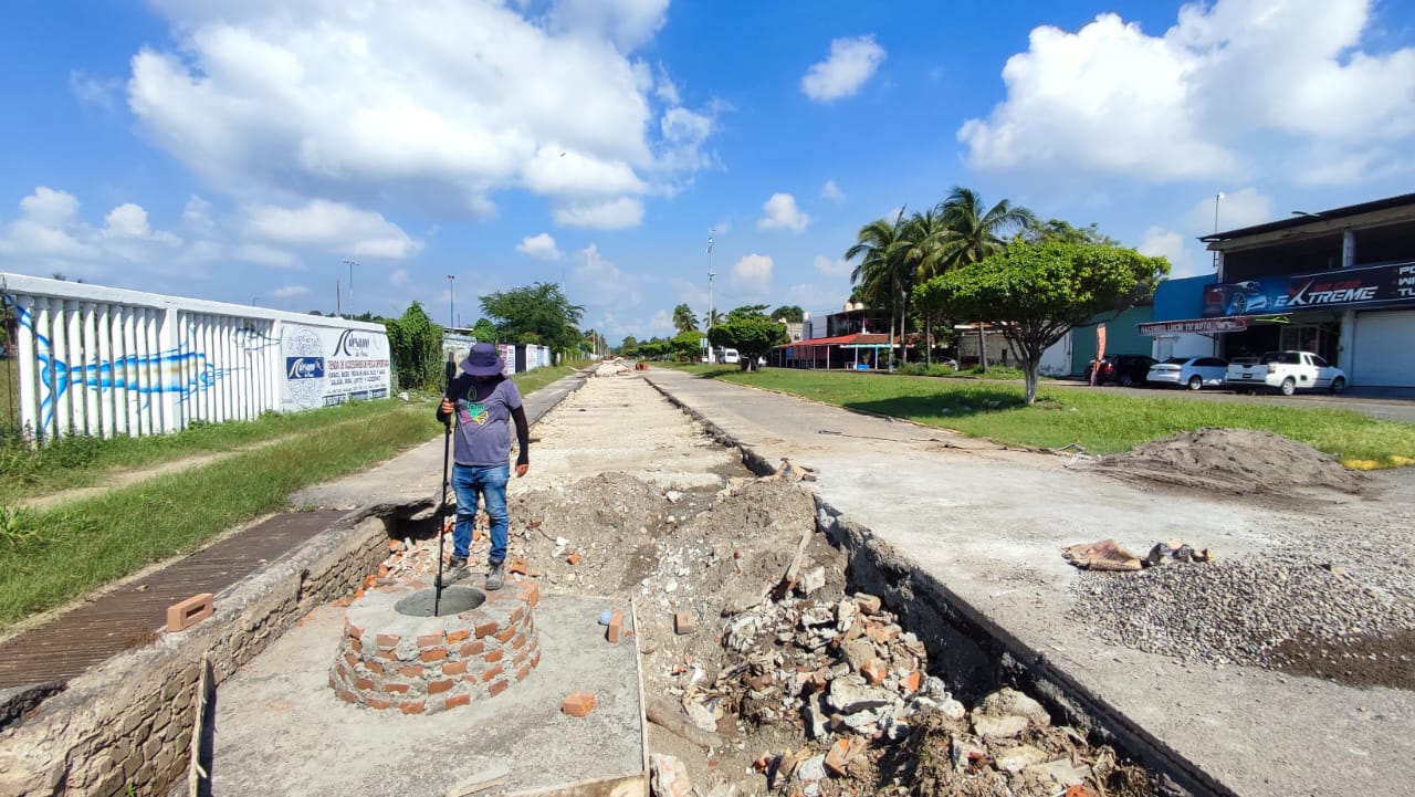
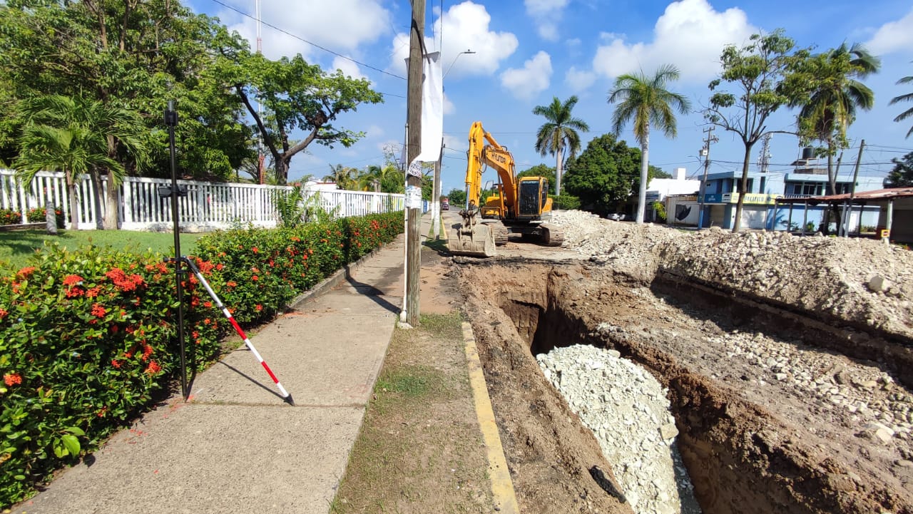
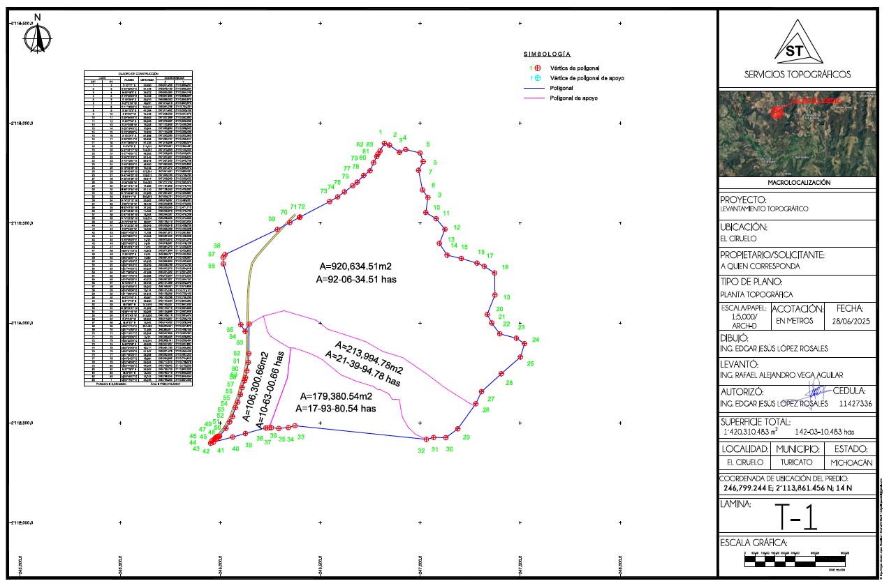
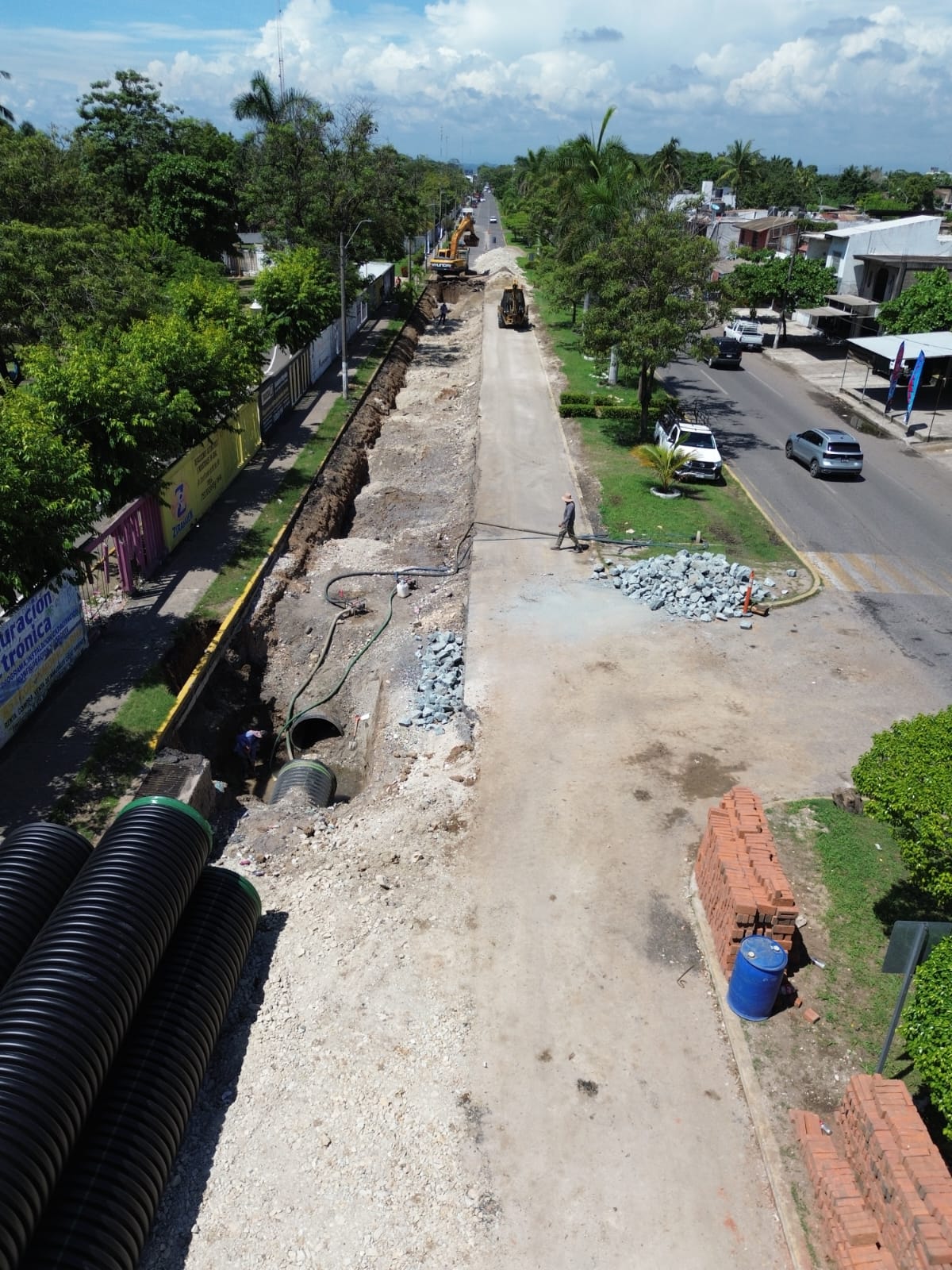
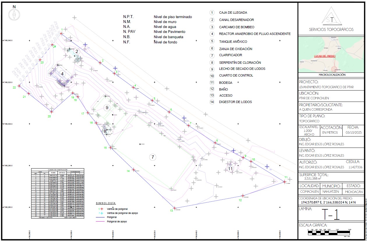
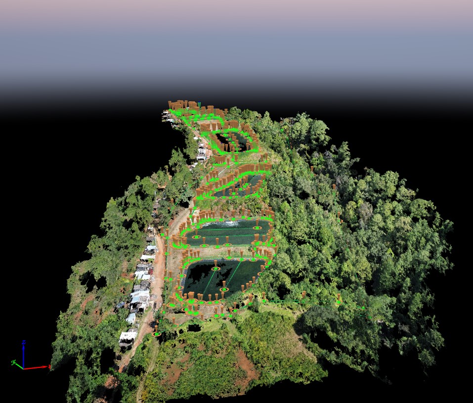
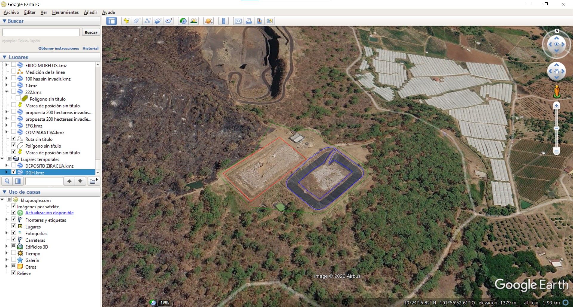
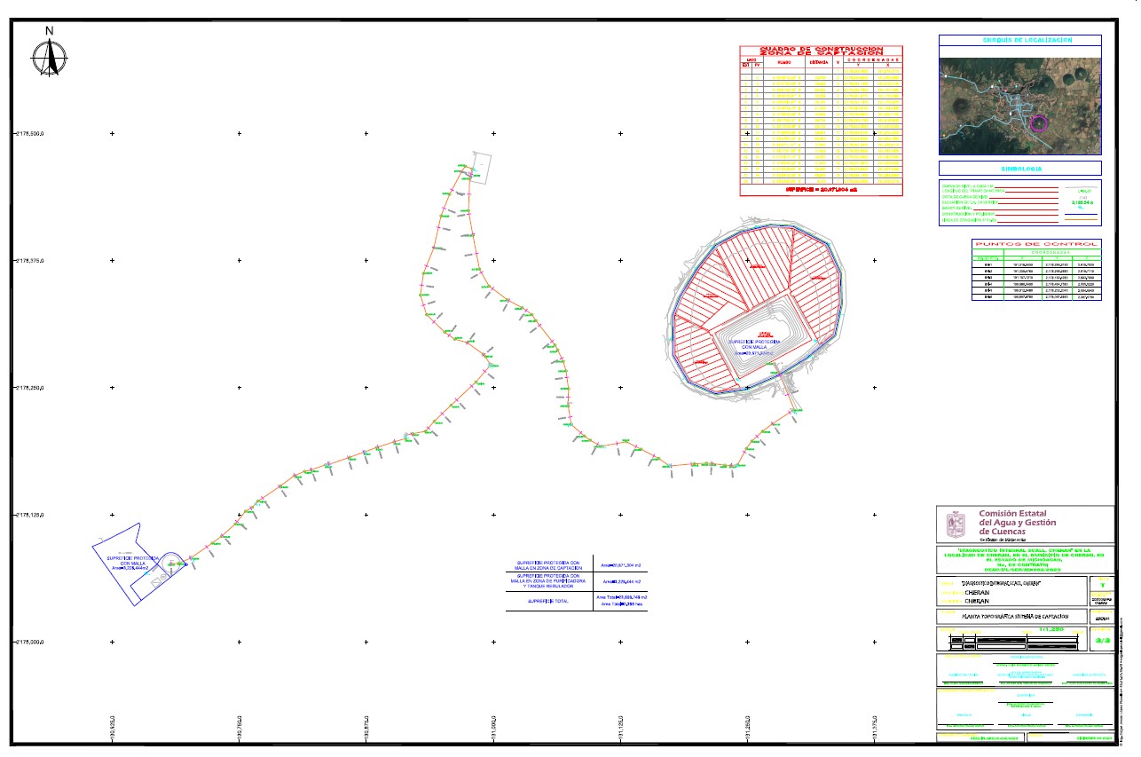
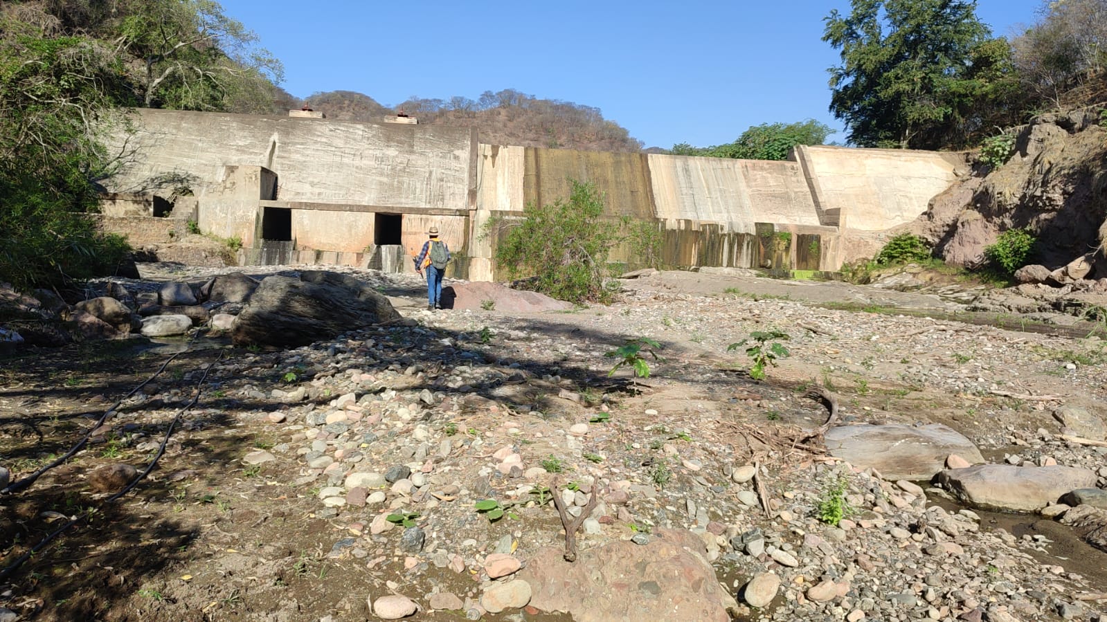
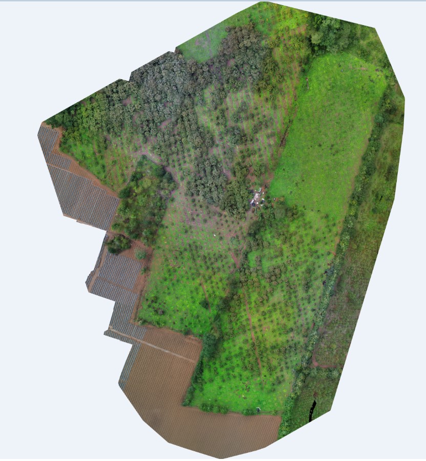
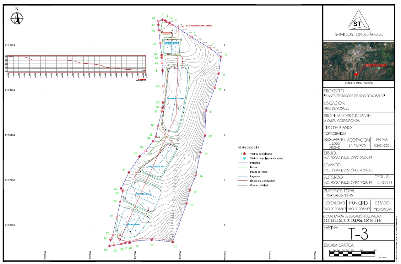
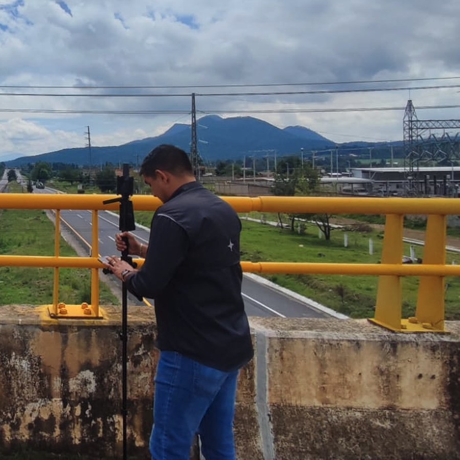
AeroFrohne supports projects in Ario de Rosales and nearby communities with topographic surveys, construction staking, orthomosaics, CAD, and visual documentation for teams that need clear measurements before decisions.

Ario de RosalesLocal service area
MichoacánRegional context
CAD + DronePlans, reports, and evidence
Local scope

Surveying for water networks, local roads, rural lots, municipal infrastructure, construction pads, and sloped terrain sites

Field control for land surveying in Ario de Rosales, Michoacán

Field control

Points, references, elevations, and visual evidence for understanding the site before decisions are made in Ario de Rosales.

Drone and orthomosaic for land surveying in Ario de Rosales, Michoacán

Drone and orthomosaic

Aerial support when site conditions allow it, useful for larger areas, roads, orchards, slopes, and construction fronts.

CAD and deliverables for land surveying in Ario de Rosales, Michoacán

CAD and deliverables

Plans, surfaces, sections, profiles, and working files ready for architecture, engineering, and construction teams.

Deliverables

Survey data that supports design, construction, and technical review

The goal is not just to measure points. It is to convert field conditions into files your team can use to estimate, model, build, and review changes on site.

Work packages for Ario de Rosales

  • Topographic survey for water networks, local roads, rural lots, municipal infrastructure, construction pads, and sloped terrain sites.
  • Contours, control points, visible boundaries, and field references in sites where topography changes quickly between roads, berms, parcels, and low-density urban areas.
  • Construction staking for axes, elevations, alignments, access points, platforms, and critical construction points.
  • Orthomosaic, field photos, point cloud, or visual documentation when the scope justifies it.
  • CAD plans, technical reports, and files ready for project review, estimating, and construction coordination.
  • Coordination with a local surveyor, expert, or authorized professional when signatures, cadastral filings, or official use are required.
Visual evidence

Aerial images, reports, and deliverables for land surveying in Ario de Rosales

Field marketing material that shows the real value of the survey: aerial context, orthomosaics, reports, plans, CAD, 3D models, and photographic evidence.

Road site documented from above for land surveying in Ario de Rosales, Michoacán
Aerial Road site documented from above

Aerial photo useful for explaining construction fronts and visible limits.

Parcel plan for land surveying in Ario de Rosales, Michoacán
Plan Parcel plan

Linework and notes for communicating boundaries, areas, and field references.

Site point cloud for land surveying in Ario de Rosales, Michoacán
3D Site point cloud

3D model for reviewing elevations, surfaces, and existing conditions.

Earthwork and platform site for land surveying in Ario de Rosales, Michoacán
Aerial Earthwork and platform site

Aerial construction image for comparing surfaces, volumes, and access.

Topographic map with inset for land surveying in Ario de Rosales, Michoacán
Map Topographic map with inset

Support map summarizing location, contours, and key survey elements.

Industrial parcel for land surveying in Ario de Rosales, Michoacán
Field Industrial parcel

Site image for commercial, industrial, and urbanization projects.

Digital terrain model for land surveying in Ario de Rosales, Michoacán
3D Digital terrain model

Technical visual for slopes, platforms, runoff, and conceptual design.

Linear topographic plan for land surveying in Ario de Rosales, Michoacán
Plan Linear topographic plan

Deliverable for roads, corridors, access points, profiles, and alignments.

Local survey expert

Meet the Civil Engineer/Surveyor

Edgar Jesús López Rosales performing field surveying work

Edgar Jesús López Rosales

Civil Engineer · Perito Topógrafo · Michoacán, Mexico

Edgar Jesús López Rosales is a civil engineer and Perito Topógrafo with Cédula Profesional 11477336 and more than 10 years of experience in topographic surveys, drone photogrammetry, and expert reports. Based at Servicios Topográficos in Apatzingán, he coordinates cadastral, judicial, and civil works surveying across Michoacán and west-central Mexico. His field workflow combines GNSS RTK, total station, AutoCAD, Civil 3D, and Pix4Dmapper to deliver clear plans, orthomosaics, point clouds, and technical files for owners, builders, and authorities.

Process

From location and scope to project-ready files

Before sending a crew or drone, the team confirms the survey purpose, expected precision, access, vegetation risks, CAD format, and whether the project needs coordination with an authorized local professional.

01. Scope

Location, area, objective, schedule, and deliverables.

02. Field

Control, points, photos, and aerial support when appropriate.

03. CAD

Contours, surfaces, visible boundaries, and files.

04. Review

Adjustments, technical notes, and local coordination.

Frequently asked questions

Questions about land surveying in Ario de Rosales

Do you support surveys in Ario de Rosales and nearby areas?

Yes. Scope depends on location, access, parcel size, required deliverables, and target schedule within Michoacán.

What materials should I send for a quote?

Send the location, any available sketch or deed, approximate area, survey objective, required date, site photos, and preferred delivery format.

Can I request CAD, orthomosaic, and field photos in the same package?

Yes. These pages are designed for projects that need ground measurement, visual evidence, and digital files for design, construction, or technical review.

Does AeroFrohne replace the local survey professional or authority?

No. If the project requires a signature, official filing, appraisal, cadastre process, or legal resolution, the work must coordinate with the authorized local professional for that jurisdiction.

Request a quote for Ario de Rosales, Michoacán

Send the location, approximate area, access photos, and intended use of the survey. AeroFrohne will respond with the recommended scope and deliverables for your project.

Contact