
Architecture and interior design
Make circulation, adjacency, furniture scale, and finish direction easier to discuss with clients before design decisions.
AeroFrohne captures room dimensions and areas, wall runs, doors, openings, and floor by floor for interiors and exteriors then organizes the agreed measurements into clear visual deliverables for renovation, permitting, restaurants, facilities, energy, data centers, warehouses, and appraisals.
Visible proof
Roof measurement reporting
A clear roof report can bring the facet diagram, total and pitched areas, linear edges, slope direction, and material-calculation assumptions into one visual handoff. These sample pages show the kinds of information a roof measurement scope can organize for review.
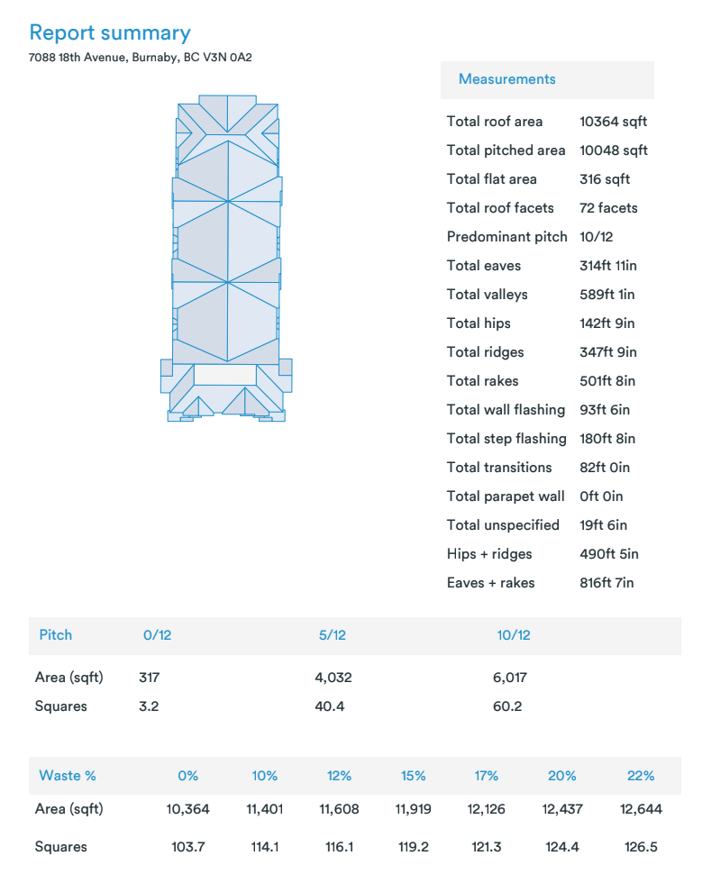
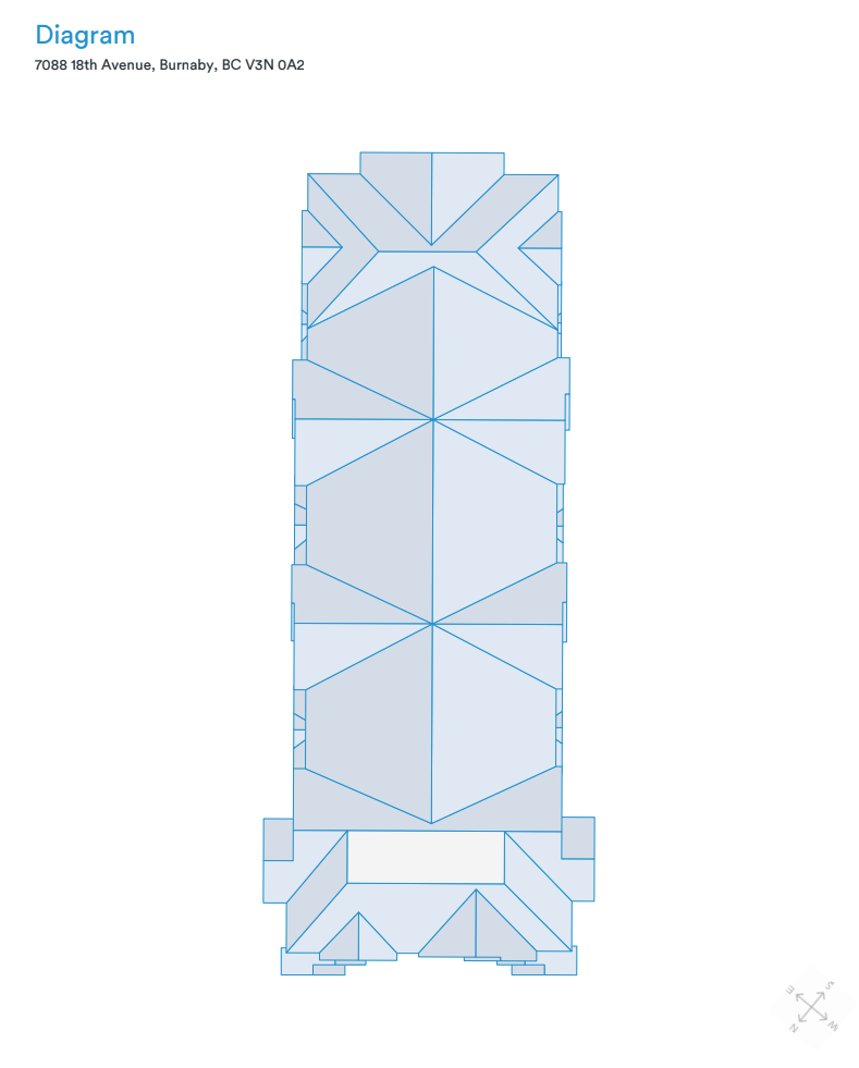
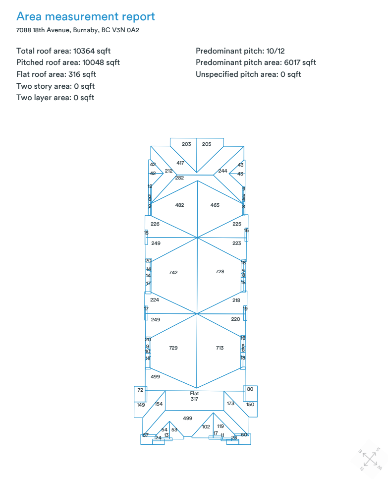
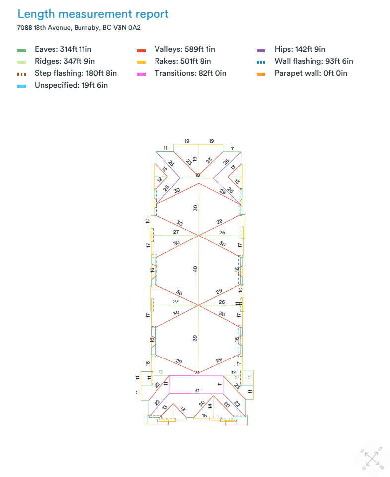
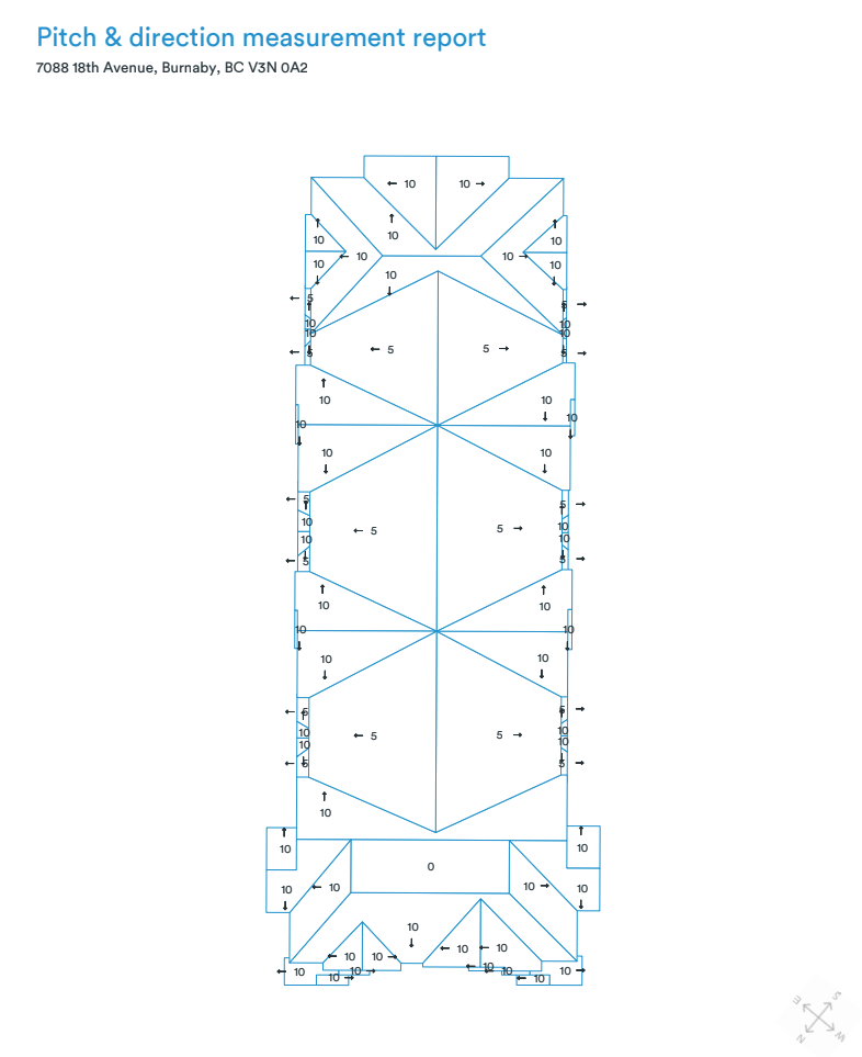
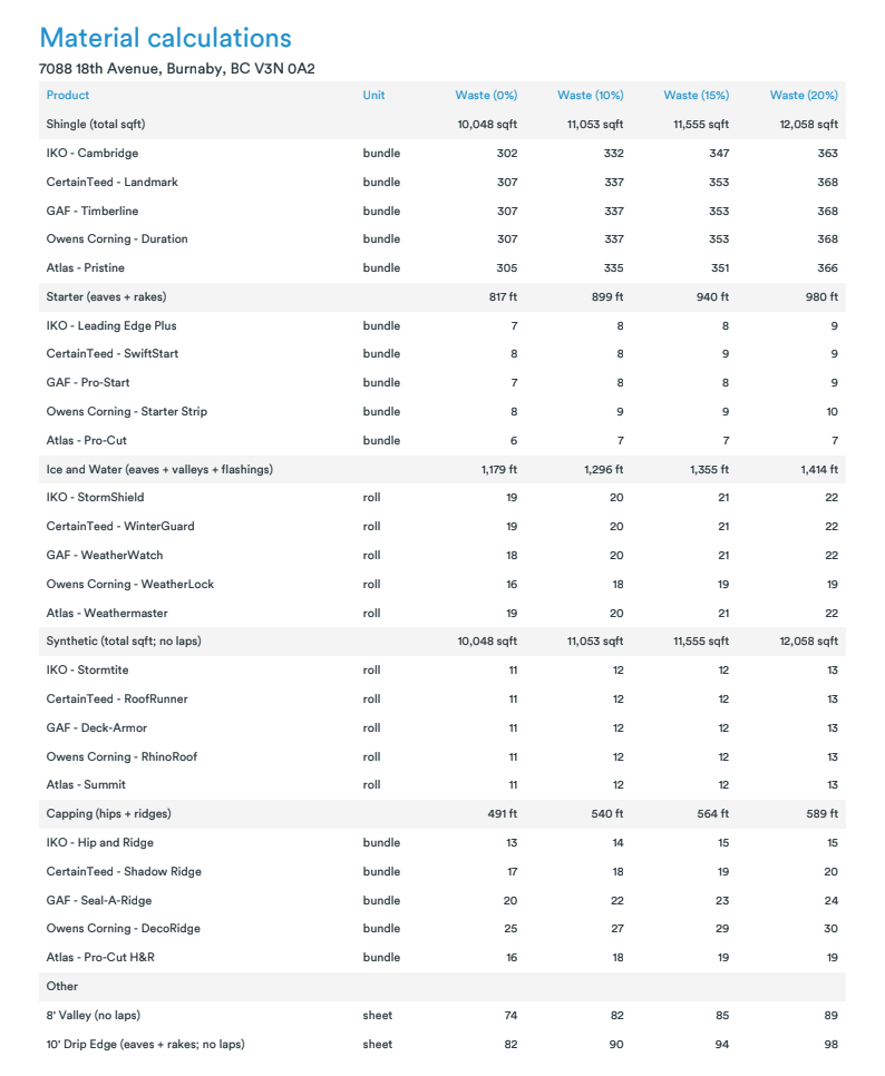
Sample report pages illustrate output types only. Roof scope, site conditions, field verification, estimates, code requirements, and construction decisions require project specific review.
PROPERTY MEASUREMENT CASE STUDY
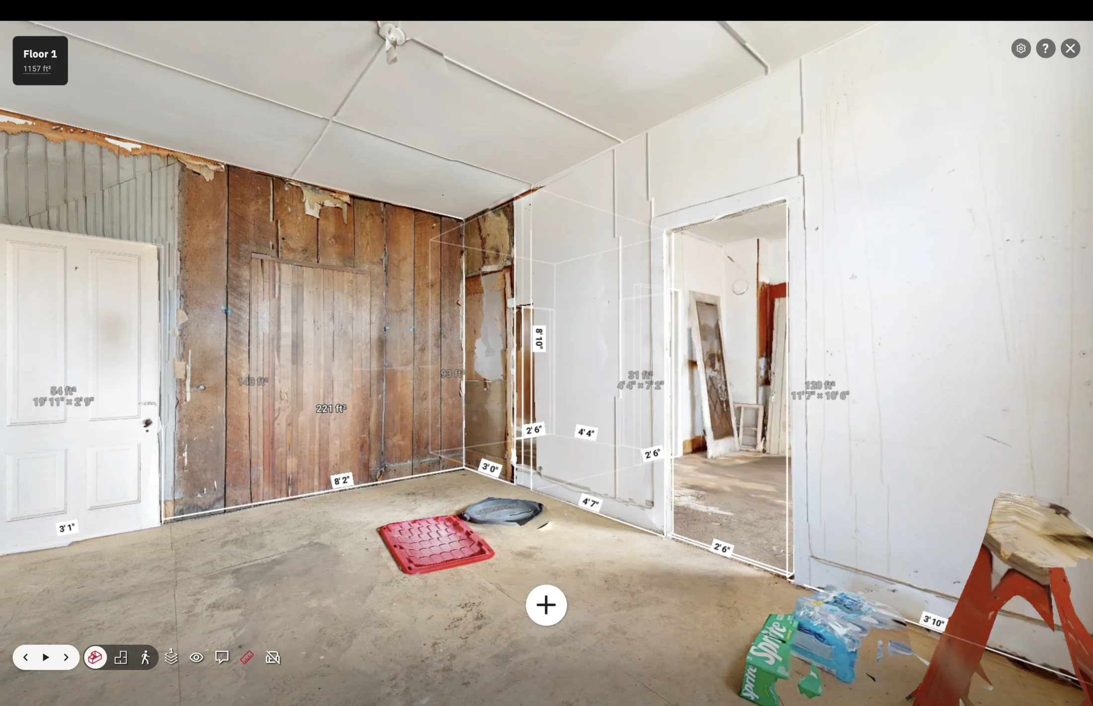
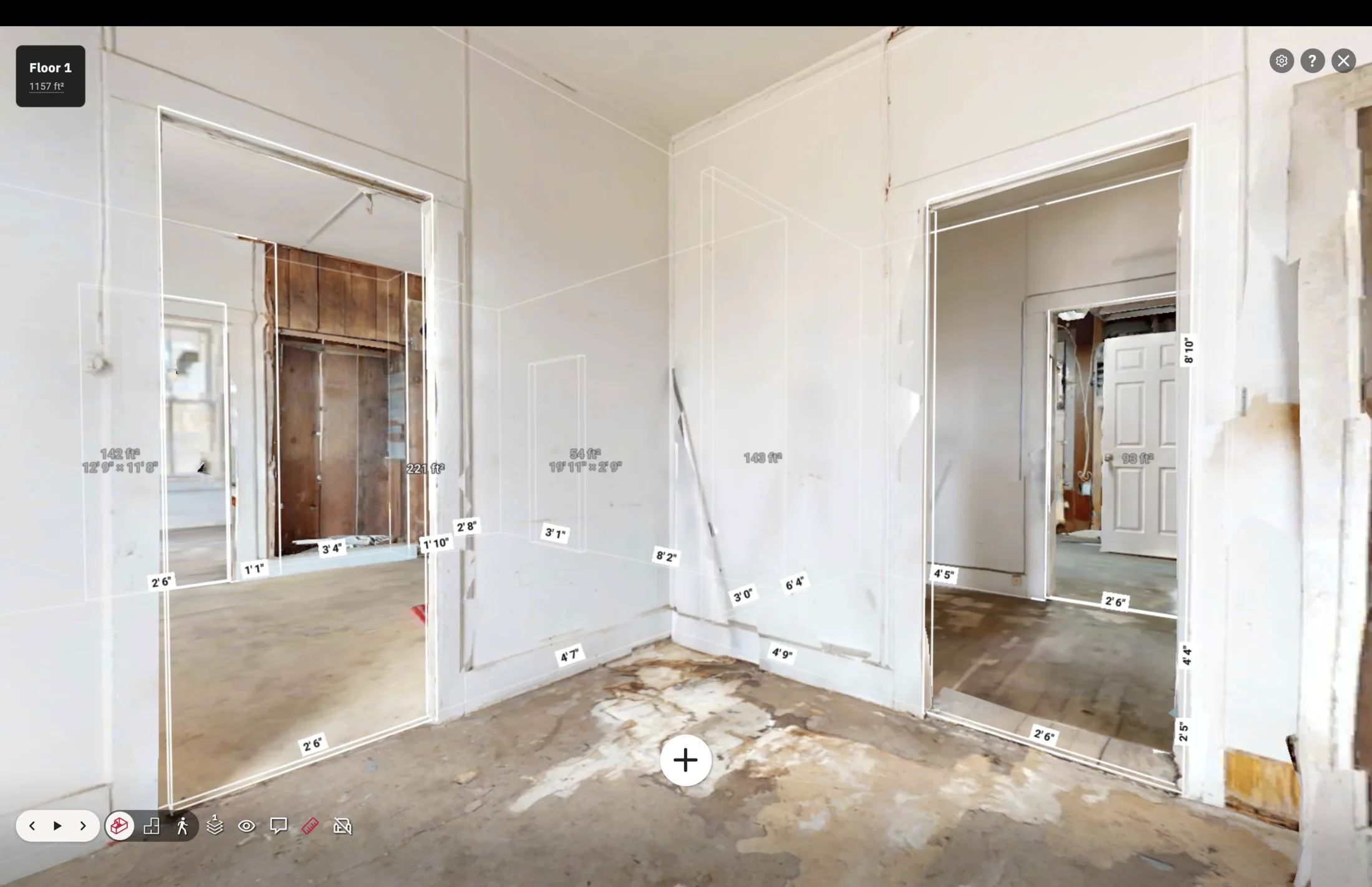
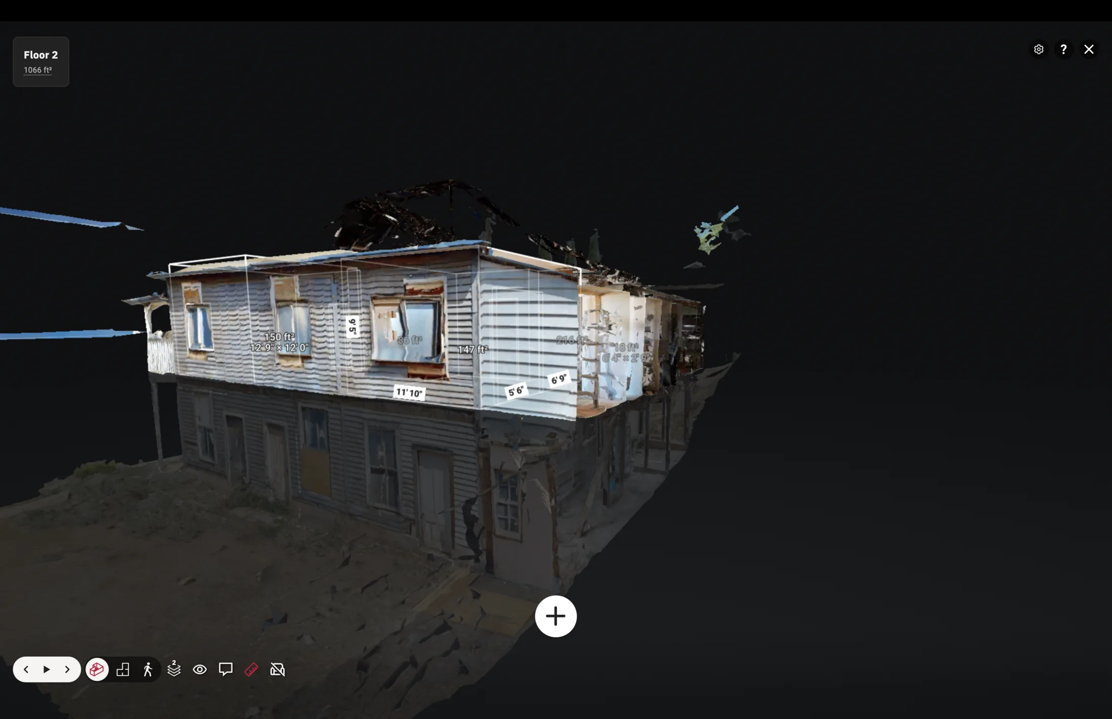
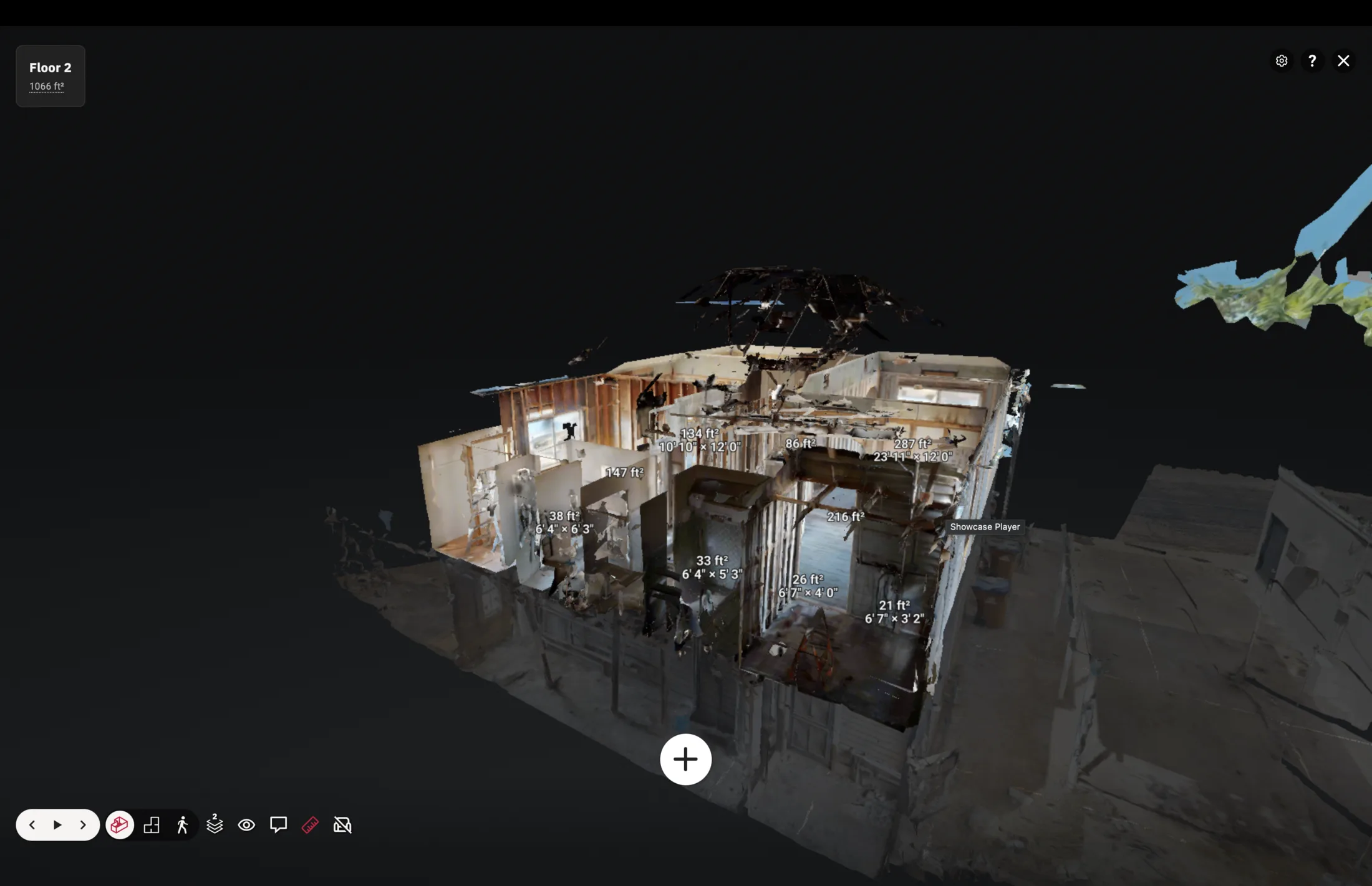
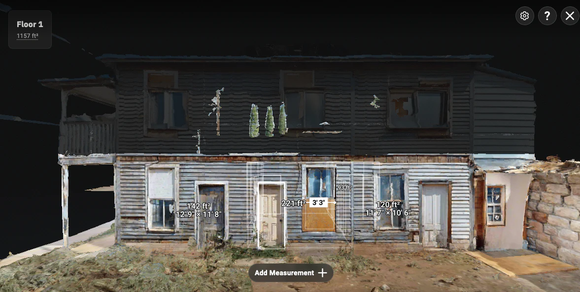
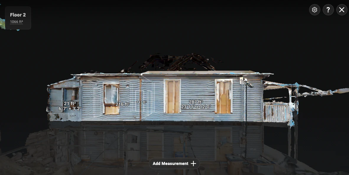
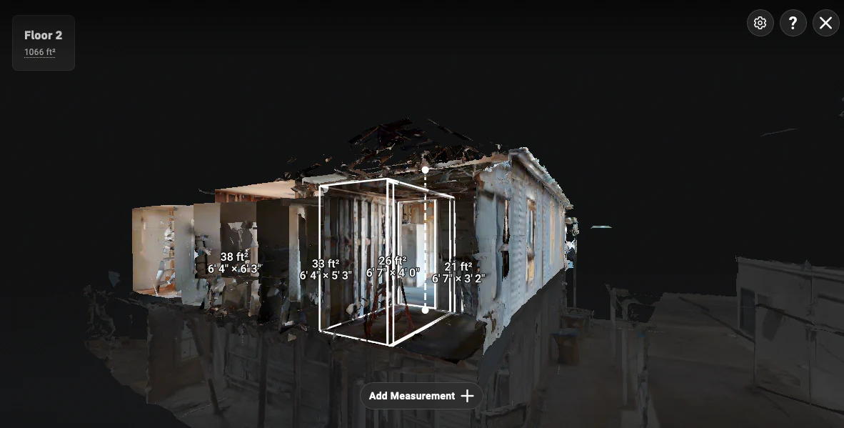
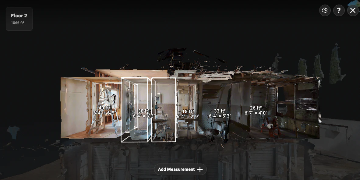
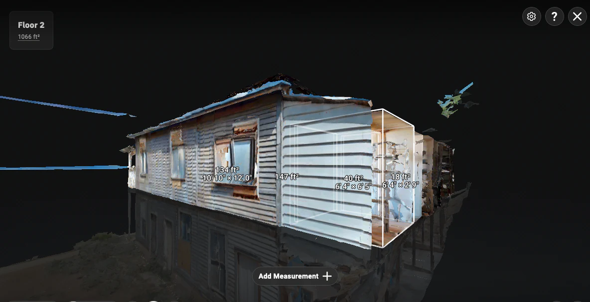
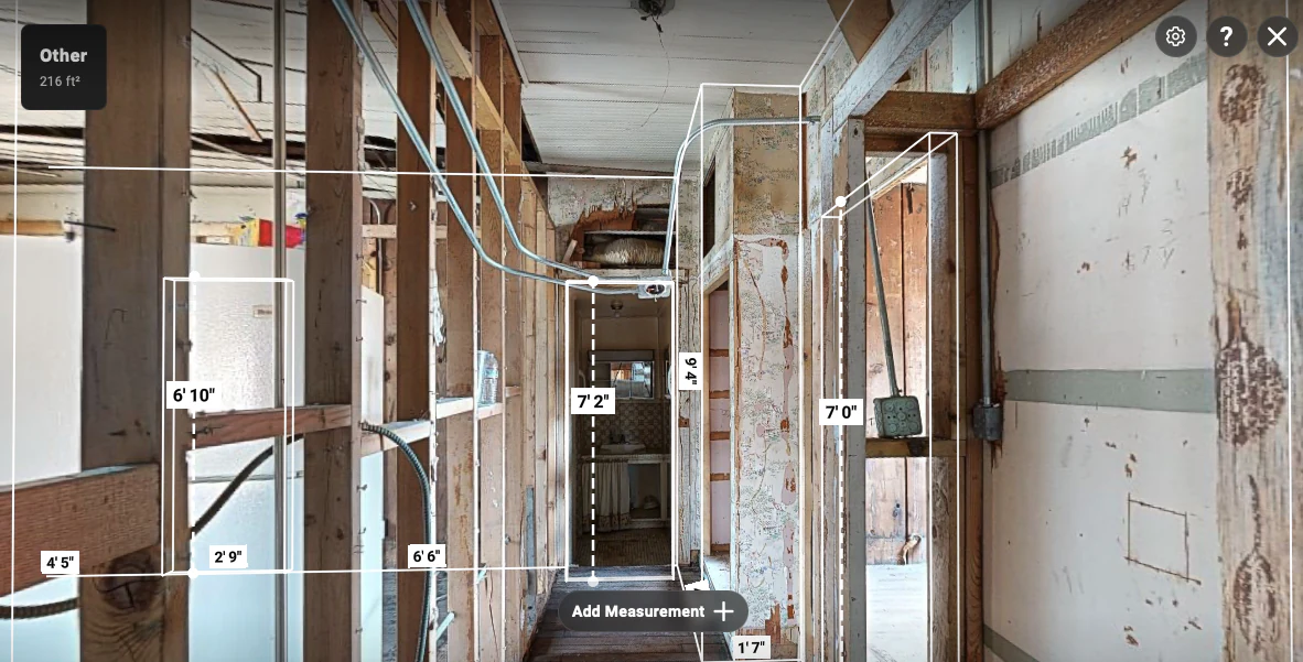
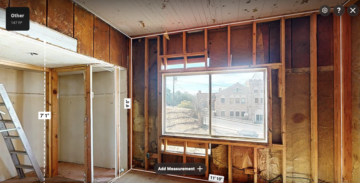
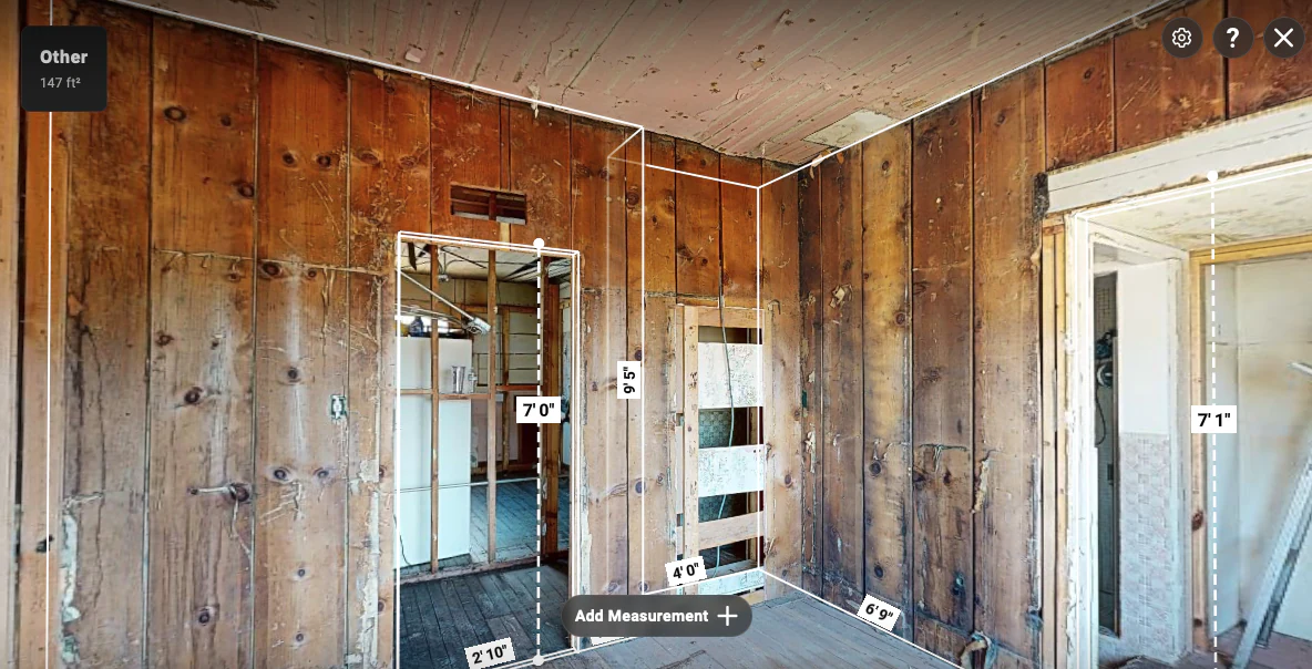
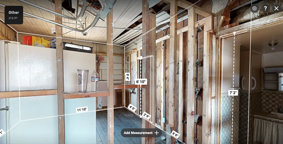
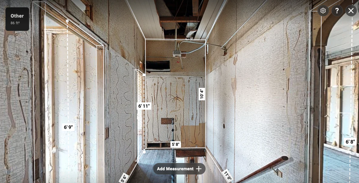
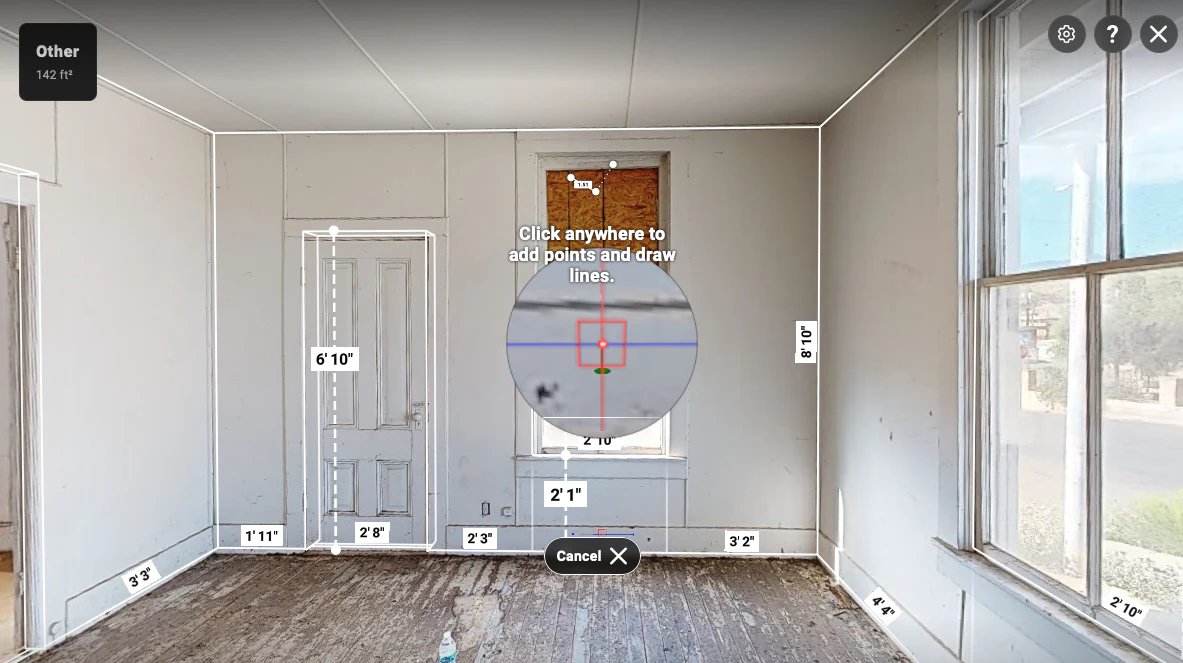
In Globe, Arizona, AeroFrohne used a Matterport model to document exterior and cutaway views with room areas, wall spans, openings, and floor level context. The model interface reports 1,157 ft² for Floor 1 and 1,066 ft² for Floor 2.
Explore the 3D model →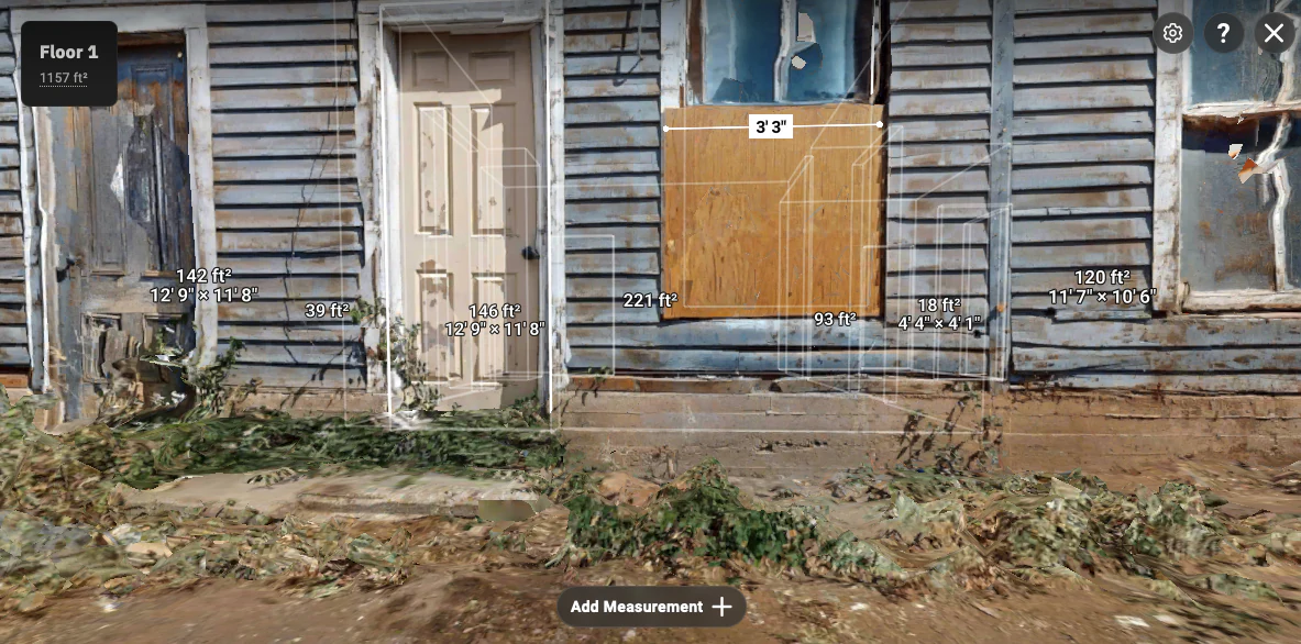
Optional drawing output
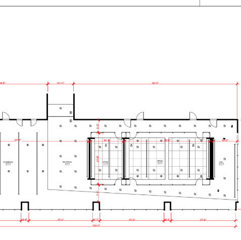
A hosted measurement view may be enough for early review. When the project needs static sheets or editable linework, AeroFrohne can separately scope a floor plan or a Scan-to-CAD package with the required layers, dimensions, and file format.
Property measurements to 3D rendering video
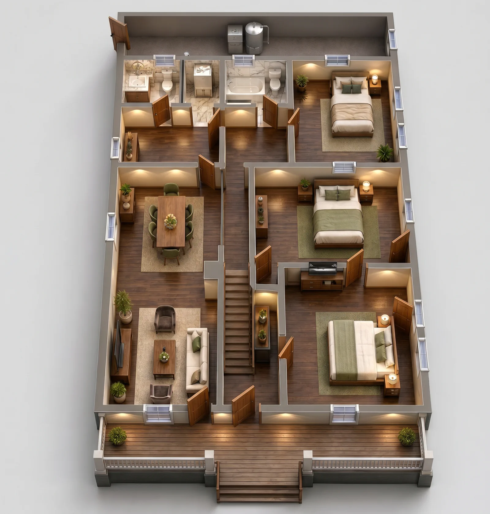
Turn documented room dimensions, wall layouts, openings, and floor areas into a clear 3D view that helps owners, designers, contractors, real estate teams, and facility managers understand spatial relationships, communicate scope, compare layout ideas, and make more informed decisions before design, construction, leasing, or renovation begins.
Industry benefits
A furnished 3D view can make the same plan easier to discuss across disciplines without replacing the documents, approvals, or verification each industry requires.
Make circulation, adjacency, furniture scale, and finish direction easier to discuss with clients before design decisions.
Provide a visual companion for orientation and coordination conversations; verified drawings remain authoritative.
Help buyers or tenants understand how rooms connect and how the property could be furnished before an in person visit.
Give operators a quick visual index of rooms, storage, stairs, circulation, and service areas for planning conversations.
Pair documented plan information with an illustrative spatial view for claim or restoration discussions; it does not determine damage, coverage, or scope.
Help nontechnical stakeholders compare layout concepts and communicate intent before feasibility, cost, and technical reviews.
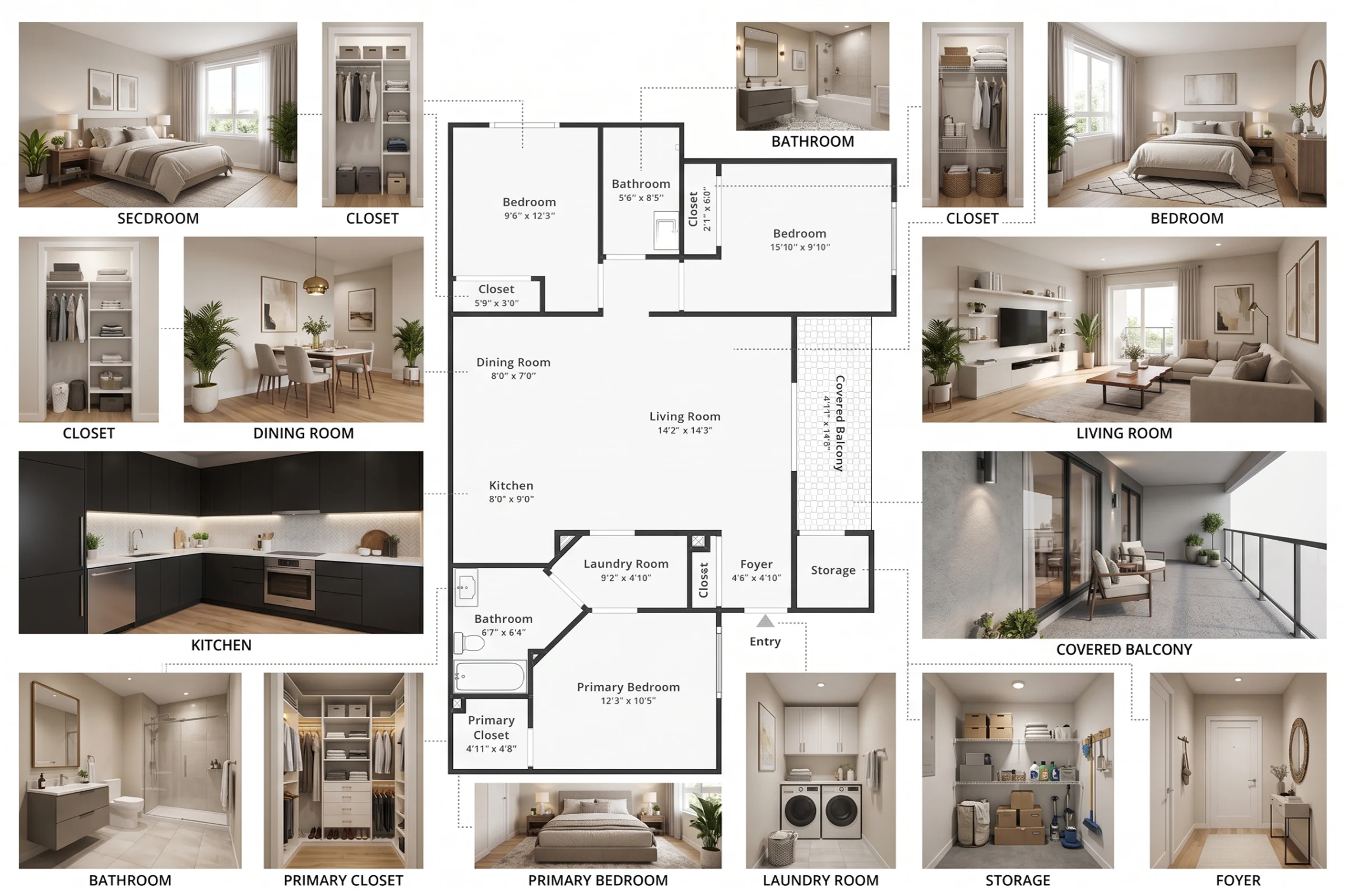
2D floor plan to 3D rendering
AeroFrohne can translate an existing 2D floor plan into a 3D floor plan or a room by room visualization set. These renderings help owners, designers, leasing teams, and project stakeholders understand layout, circulation, finishes, furniture scale, and spatial relationships before construction or renovation decisions.
Explore 3D rendering services →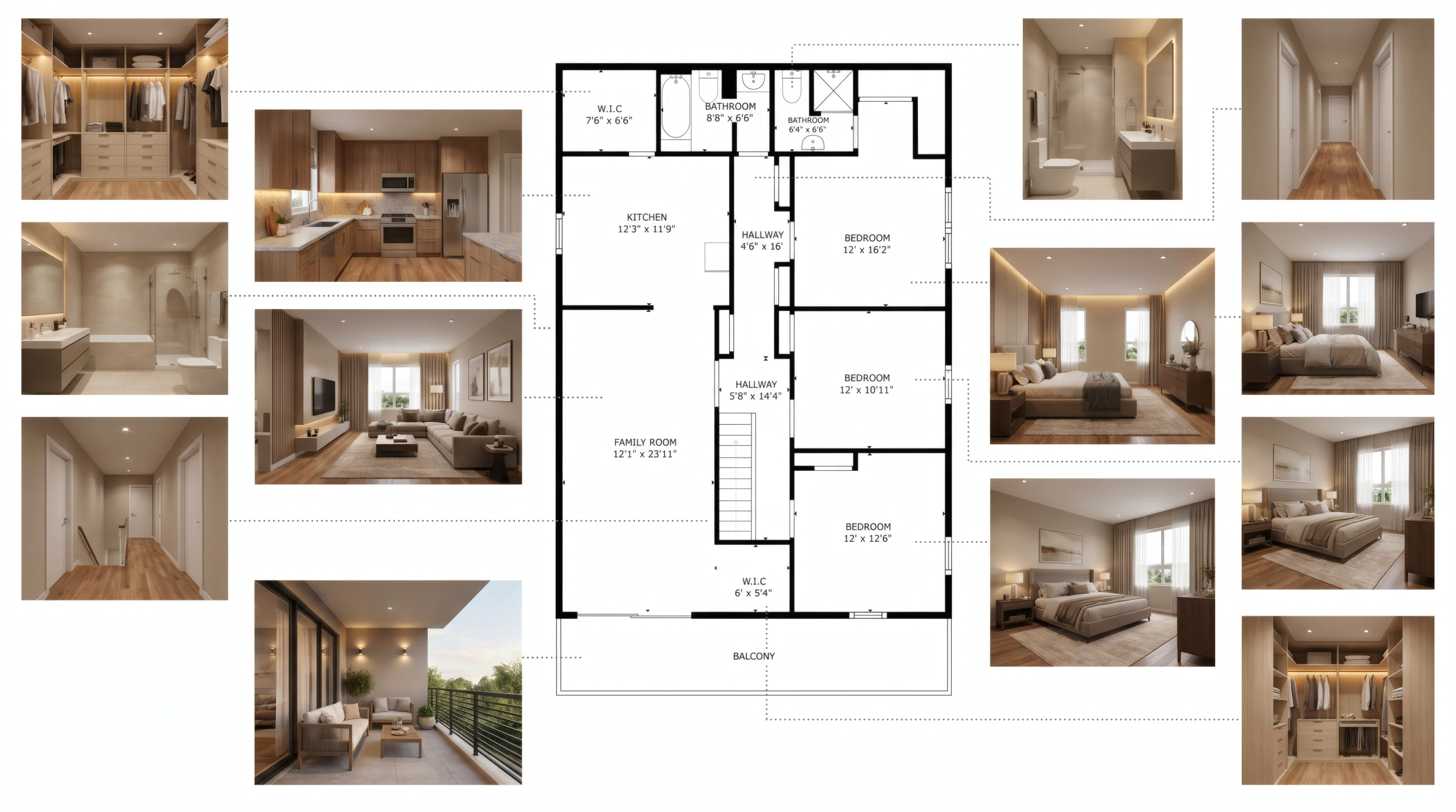
Choose the output
Every quote should define the measurement scope, intended use, required file format, access conditions, and verification expectations before capture.
Floor by floor and room level dimensional context for planning, property records, and remote review.
Wall runs, doorway widths, and opening dimensions for early layout and project scope conversations.
Optional visual plan outputs when a static drawing is more useful than an interactive measurement view.
Remote dimensional context that helps owners, designers, and contractors prepare for project specific field verification.
Repeatable capture and naming for portfolios, tenant spaces, equipment rooms, and operational records.
Downstream drawing or model production when the project needs more than measurement views or a schematic plan.
Clear boundaries
| Need | Start here | Typical output |
|---|---|---|
| Room, wall, opening, and floor area dimensions | Property Measurements | Measurement views, area summaries, optional floor plans |
| Interactive remote walkthrough | Matterport 3D Tours | Hosted digital twin, tags, and shareable tour |
| DWG plans, RCPs, elevations, or sections | Scan to CAD | CAD drawings and sheet packages |
| Revit or IFC existing conditions | Scan to BIM | BIM model and point cloud coordination |
| Parcel boundaries, ALTA, or regulated survey work | Land Surveying | Scope determined by the appropriate survey professional |
Capture method and limitations
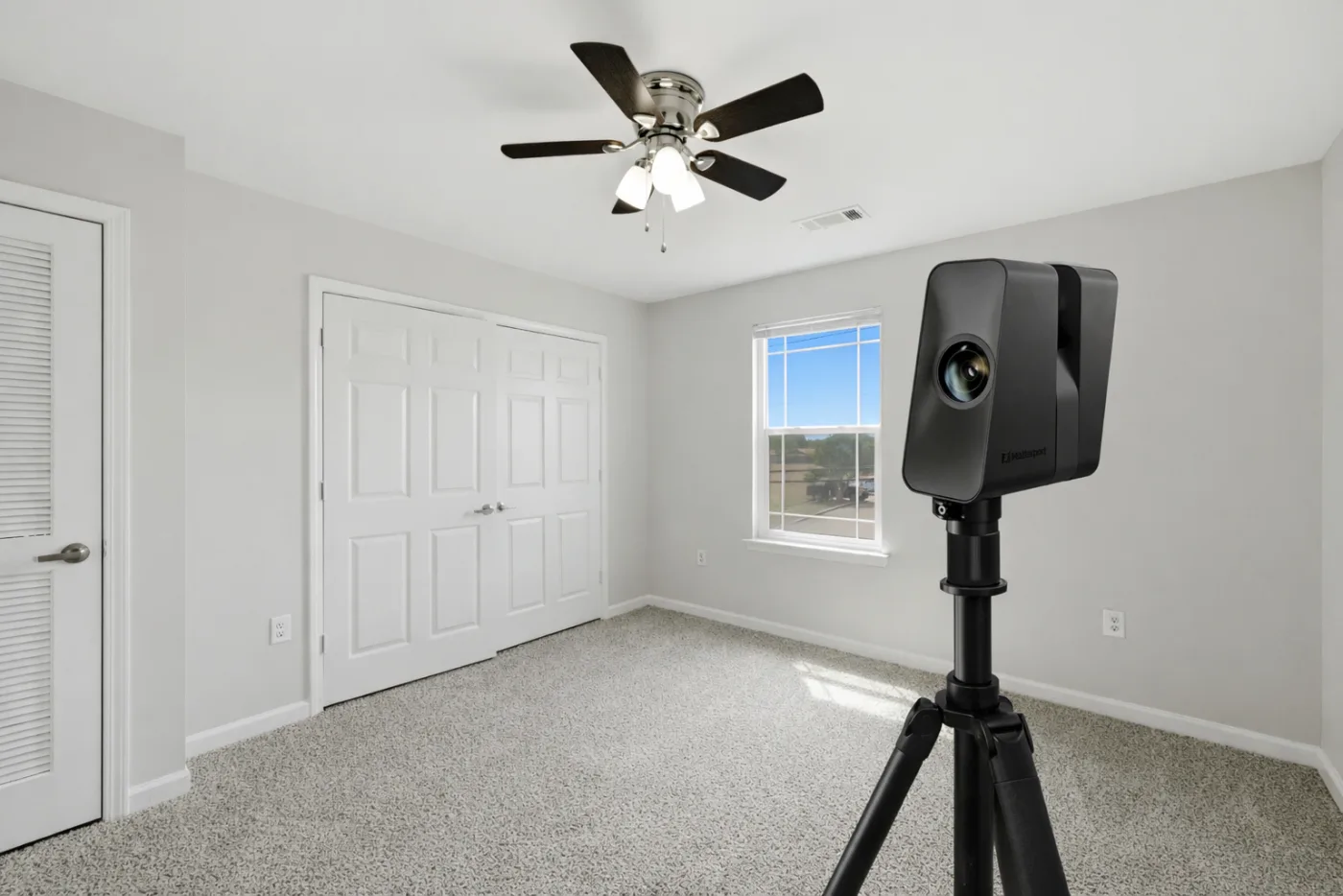
AeroFrohne uses Matterport Pro3 and Leica BLK LiDAR to combine visuals with accurate measurements for your ANSI/RICS schematic plans, CAD outputs, OBJs, BIM LOD 200+ models, or SKX files.
Capture workflow
Confirm the property, intended use, areas to capture, priority dimensions, required tolerance, access, and file formats.
Document the agreed spaces with a measurement oriented scan path and visual coverage plan.
Check coverage, labels, obvious occlusions, room relationships, and the agreed deliverable scope.
Provide the hosted view, measurement context, floor plans, or coordinated CAD, BIM, and E57 outputs included in the quote.
Frequently asked
Depending on scope and visibility, AeroFrohne can document room dimensions and areas, wall runs, doorway or opening widths, floor level area totals, and visual existing condition context. The quote should identify the exact dimensions and outputs required.
Accuracy depends on the capture method, site conditions, visibility, measurement type, and final deliverable. Tell AeroFrohne the intended use and required tolerance before capture so the correct workflow and verification level can be scoped.
Yes. A schematic floor plan, dimensioned drawing, CAD sheet, and BIM model are different deliverables. AeroFrohne can quote the appropriate output after reviewing the property and intended use.
Yes. Send the clearest available PDF, image, CAD file, or plan set plus any reference images and requested materials. AeroFrohne can quote a 3D floor plan, room by room renderings, or both. Rendered finishes and furnishings are illustrative unless exact selections are included in the scope.
Choose Scan to CAD when you need editable DWG drawings, reflected ceiling plans, elevations, sections, or formal sheet packages. Choose Scan to BIM when the project requires Revit, IFC, coordinated model geometry, or point cloud-based model development.
No. This service documents building interiors and agreed property spaces. Parcel boundaries, ALTA or NSPS work, easements, legal descriptions, and regulated survey deliverables require the appropriate licensed land-surveying scope.
Send the address, building type, approximate square footage, number of levels, areas to capture, required dimensions, intended use, preferred file format, access or occupancy notes, existing plans, and deadline.
Ready to scope it?
Include the address/coordinates, approximate size, levels, priority measurements, intended use, access notes, desired format, and deadline.
Browse AeroFrohne's published service pages by country and region, or open a representative location below. A listed page does not imply a staffed local office; project availability, travel, licensing, and deliverables are confirmed for each scope.